Mapped3D 3D Printed Maps Auckland, New Zealand
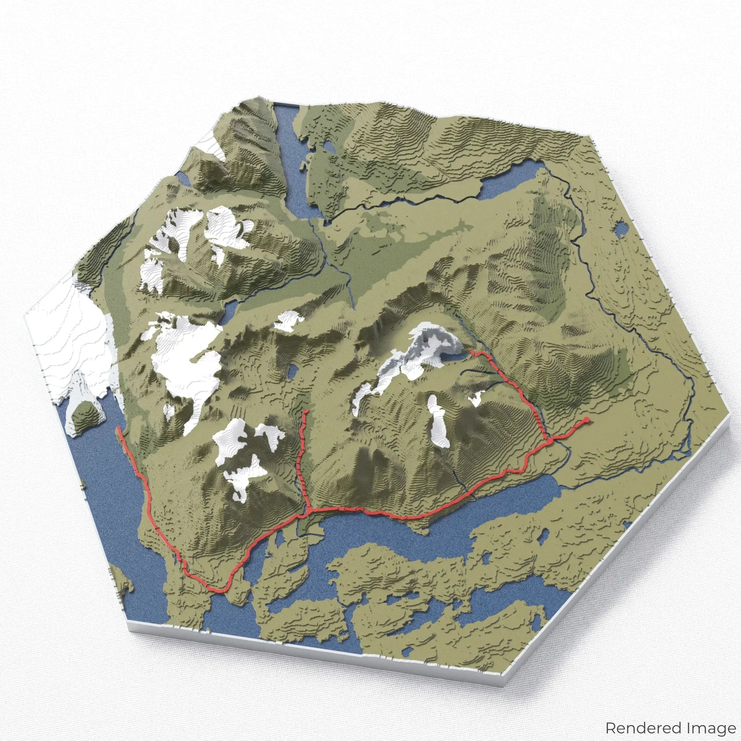
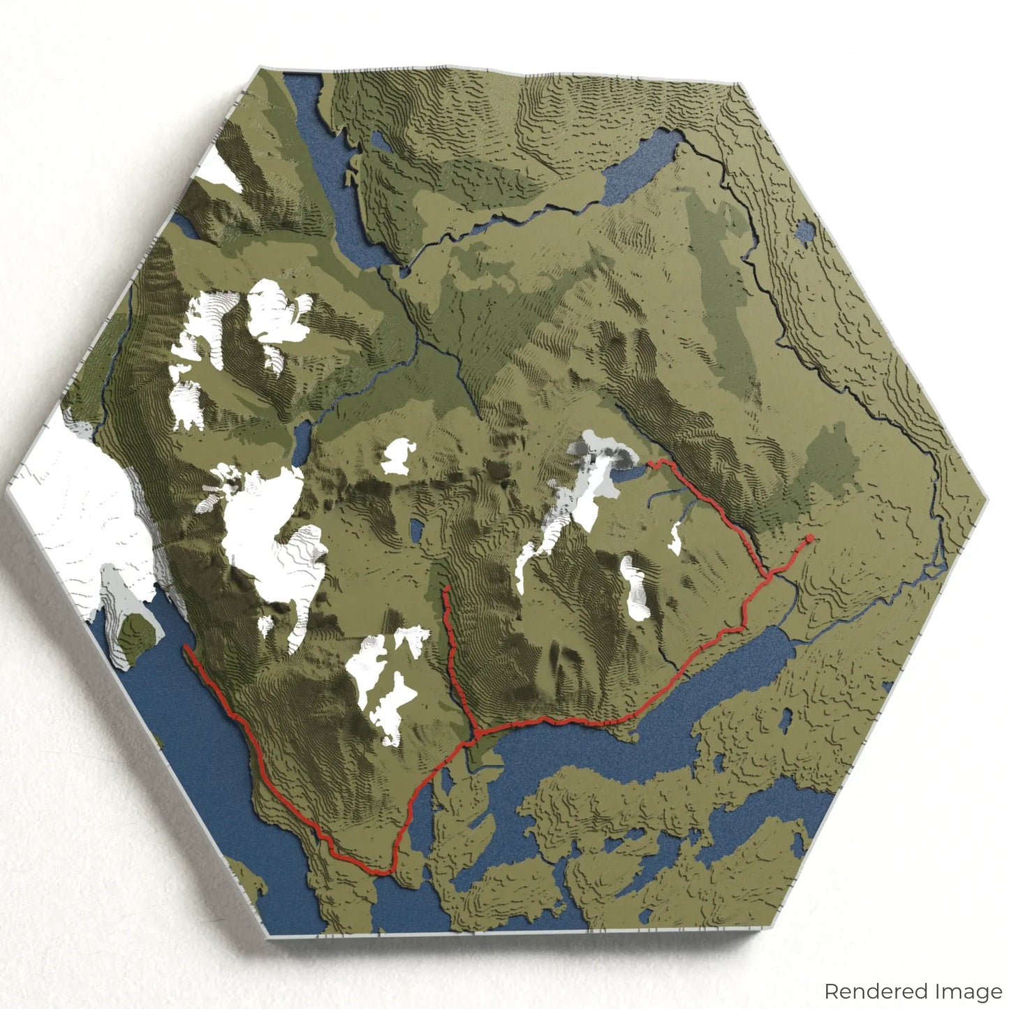
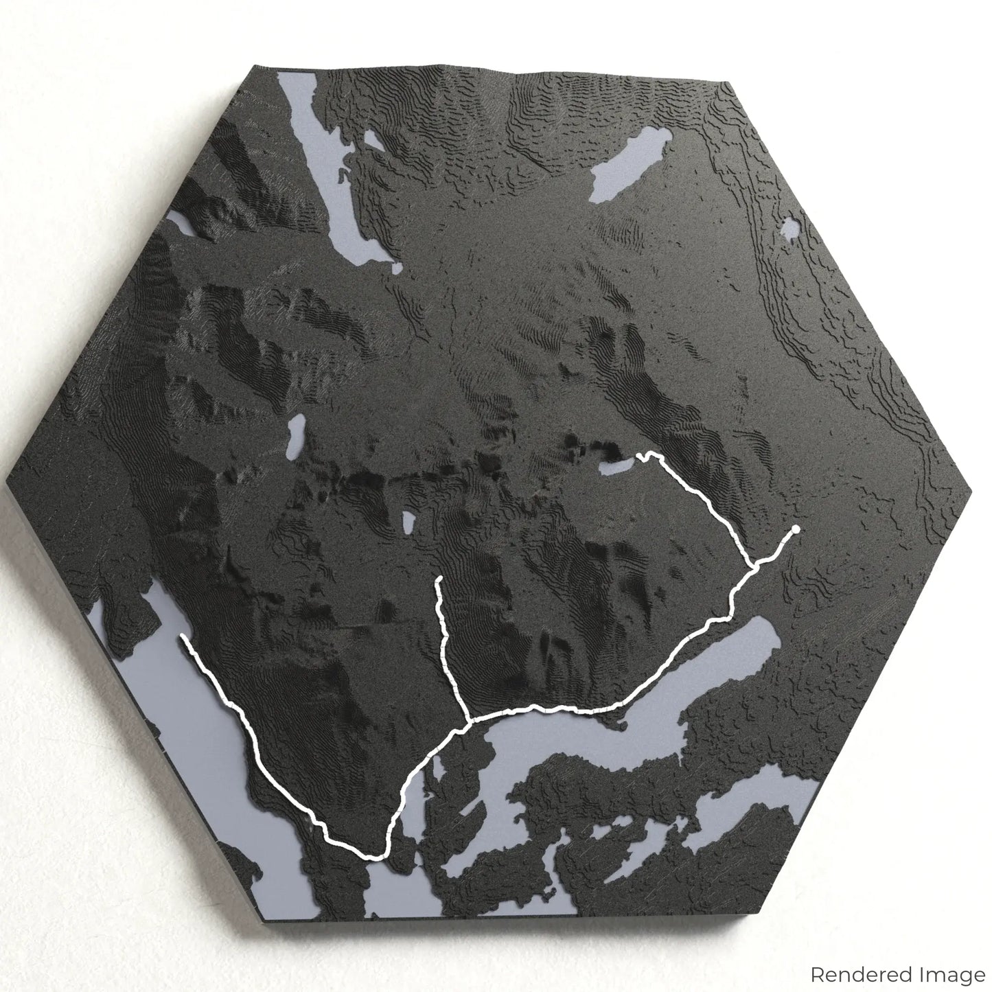
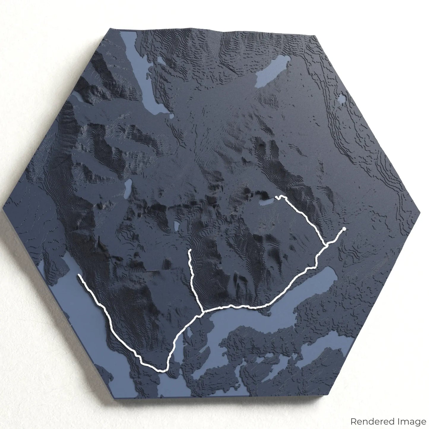
Torres del Paine W Circuit 3D Map
Torres del Paine W Circuit 3D Map
ORDERS NOT SHIPPED TILL SEPTEMBER!!!
Couldn't load pickup availability
Embark on the Torres del Paine W Circuit
Explore the awe-inspiring landscapes of Patagonia with our 3D topographic map of the Torres del Paine W Circuit. This legendary trek offers striking granite peaks, shimmering glacial lakes, and pristine wilderness.
A Trek Through Patagonia’s Wild Beauty
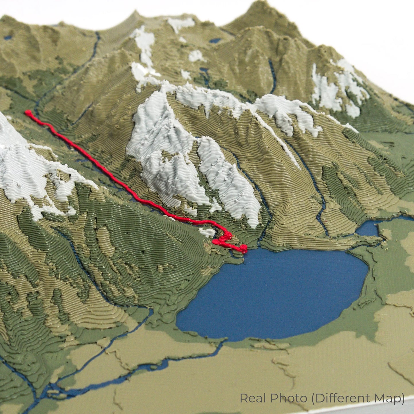
The Torres del Paine W Circuit spans approximately 80 kilometres (50 miles), winding through dramatic valleys, past towering glaciers, and along turquoise lakes. Key highlights include the iconic Torres del Paine, the magnificent Grey Glacier, and the lush French Valley. Whether you’ve completed this epic trek or have it on your adventure list, our handcrafted map captures the essence of the W Circuit.
Custom Trail Keepsake
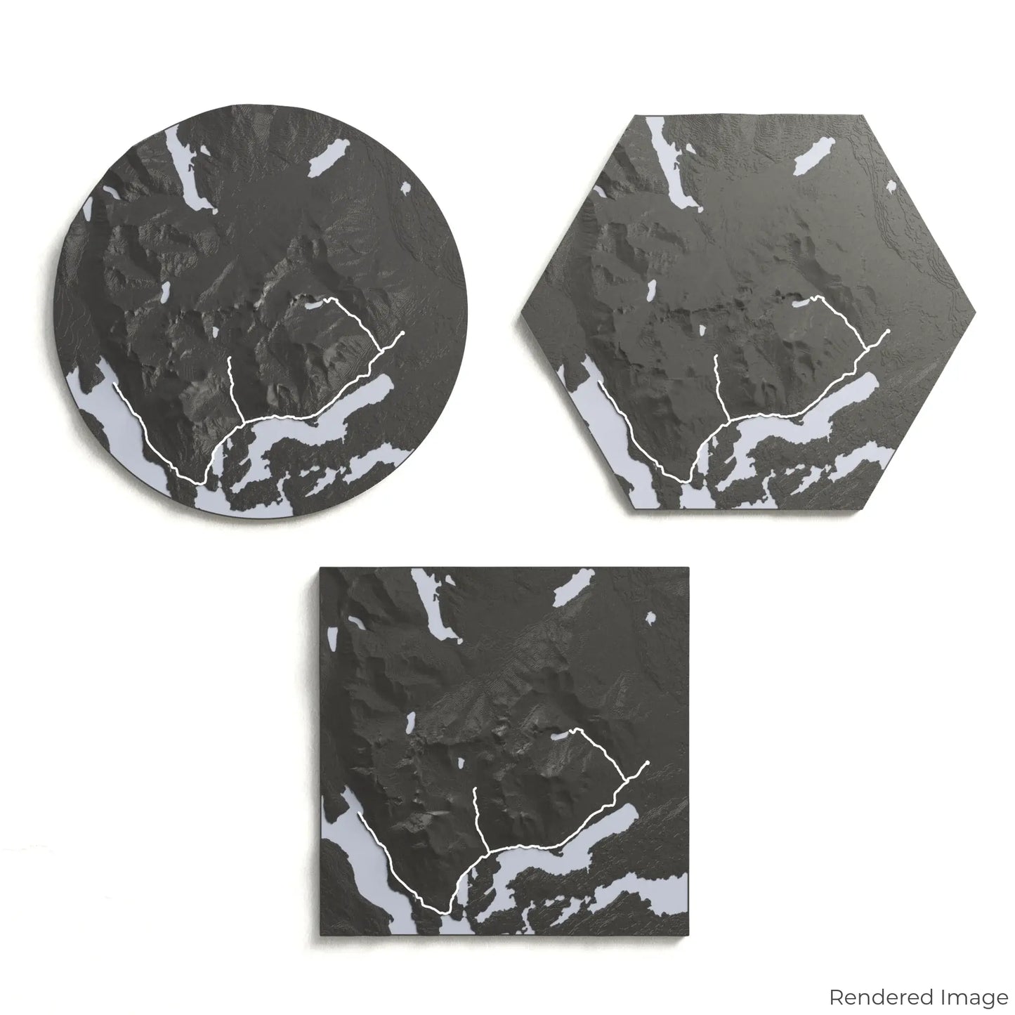
Choose from four striking colour themes and three unique shapes to create an eye-catching centrepiece for your wall or table. This handcrafted map is the perfect way to celebrate your journey along the Torres del Paine W Circuit or as a meaningful gift for fellow hikers.
Pick the Perfect Size and Shape
Circle: 221 x 221 x 34 mm (8.7 x 8.7 x 1.3 inches)
Hexagon: 243 x 212 x 34 mm (9.6 x 8.3 x 1.3 inches)
Square: 198 x 198 x 34 mm (7.8 x 7.8 x 1.3 inches)
Precision Craftsmanship for Lasting Memories
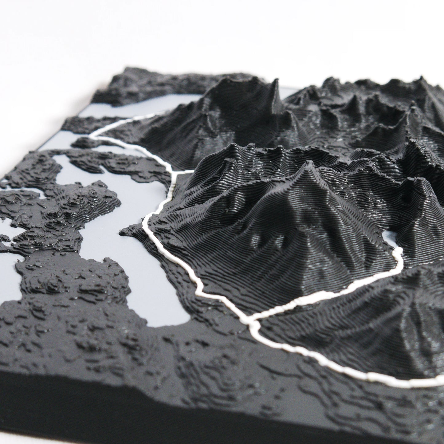
Our maps are meticulously crafted using advanced colour 3D printing technology and PLA, a durable and plant-based plastic.
Please Note: Some product photos are digitally rendered for illustrative purposes and are labelled as "Rendered Image" for clarity. The actual product may show slight variations and natural imperfections due to the 3D printing process and material properties.
Take Patagonia’s Splendor Home
Celebrate your love for Patagonia’s remote wilderness with this one-of-a-kind keepsake. Whether you're reminiscing about your adventure or planning your next trek, this 3D map is a tribute to the natural wonder of the Torres del Paine W Circuit.
Order now and let us create a memento as unforgettable as your journey!
Data Sources
Our maps are created using high-precision topographic data from the following sources:
OpenStreetMap: openstreetmap.org/copyright
Copernicus WorldDEM-30: Produced using Copernicus WorldDEM-30 © DLR e.V. 2010-2014 and © Airbus Defence and Space GmbH 2014-2018, provided under COPERNICUS by the European Union and ESA; all rights reserved.
Share