Mapped3D 3D Printed Maps Auckland, New Zealand
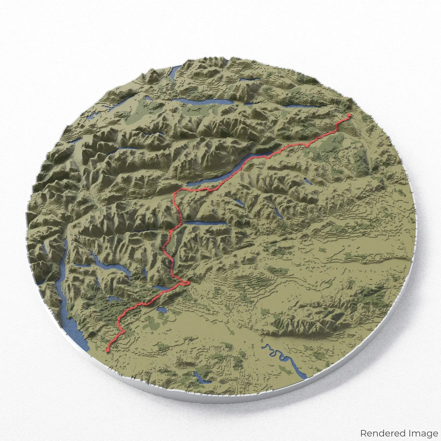
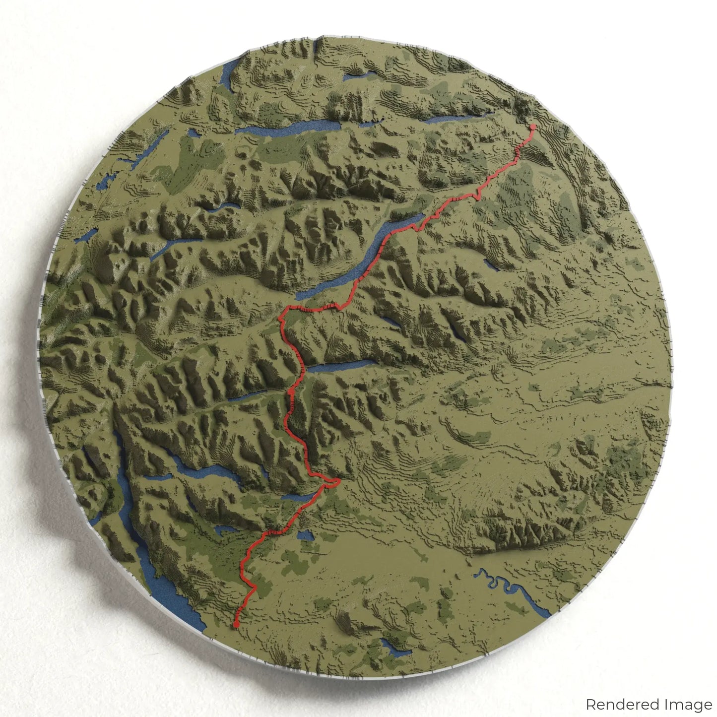
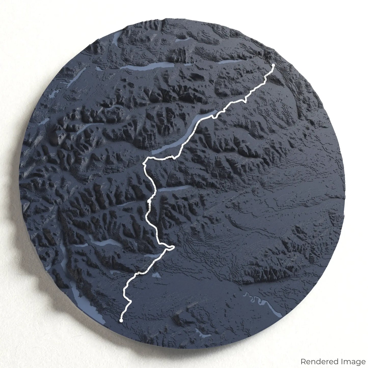
Rob Roy Way 3D Map
Rob Roy Way 3D Map
ORDERS NOT SHIPPED TILL SEPTEMBER!!!
Couldn't load pickup availability
Follow the Legacy of Rob Roy
Step into the footsteps of Scotland’s most legendary outlaw with our 3D topographic map of the Rob Roy Way. This scenic long-distance trail winds through the stunning landscapes of the Scottish Highlands, rich with history and breathtaking views.
A Trail Through History and Nature
The Rob Roy Way spans approximately 127 kilometres (79 miles), guiding hikers from Drymen to Pitlochry through lush woodlands, serene lochs, and rugged glens. Following routes once used by the infamous Rob Roy MacGregor, this trail blends fascinating Scottish heritage with unparalleled natural beauty. Whether you've completed this historic journey or dream of experiencing it, our handcrafted map captures the essence of the Rob Roy Way.
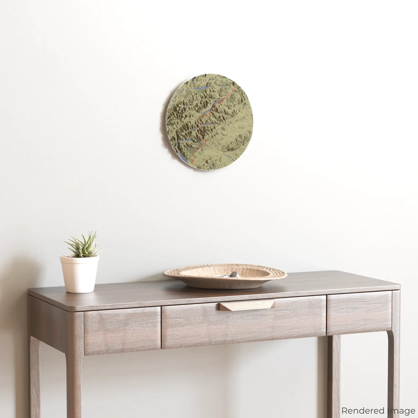
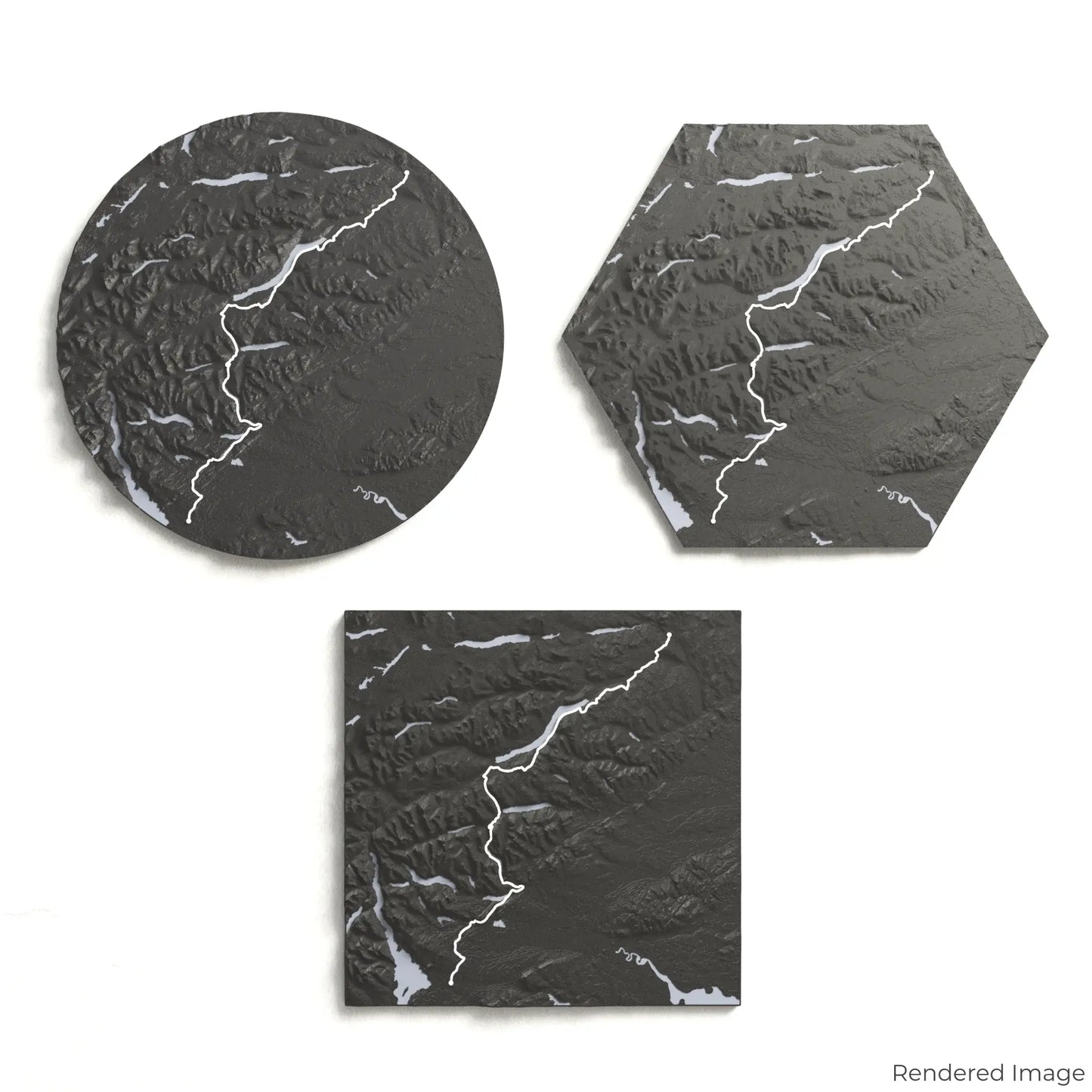
Personalise Your Highland Keepsake
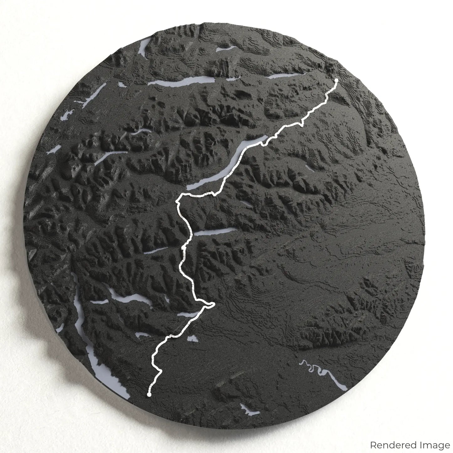
Choose from four striking colour themes and three unique shapes to create a stunning centrepiece for your wall or table. This handcrafted map is the perfect way to celebrate your Rob Roy Way adventure or as a thoughtful gift for fellow history lovers and hikers.
Select the Ideal Size and Shape
Circle: 222 x 222 x 19 mm (8.7 x 8.7 x 0.8 inches)
Hexagon: 242 x 212 x 19 mm (9.6 x 8.3 x 0.8 inches)
Square: 198 x 198 x 19 mm (7.8 x 7.8 x 0.8 inches)
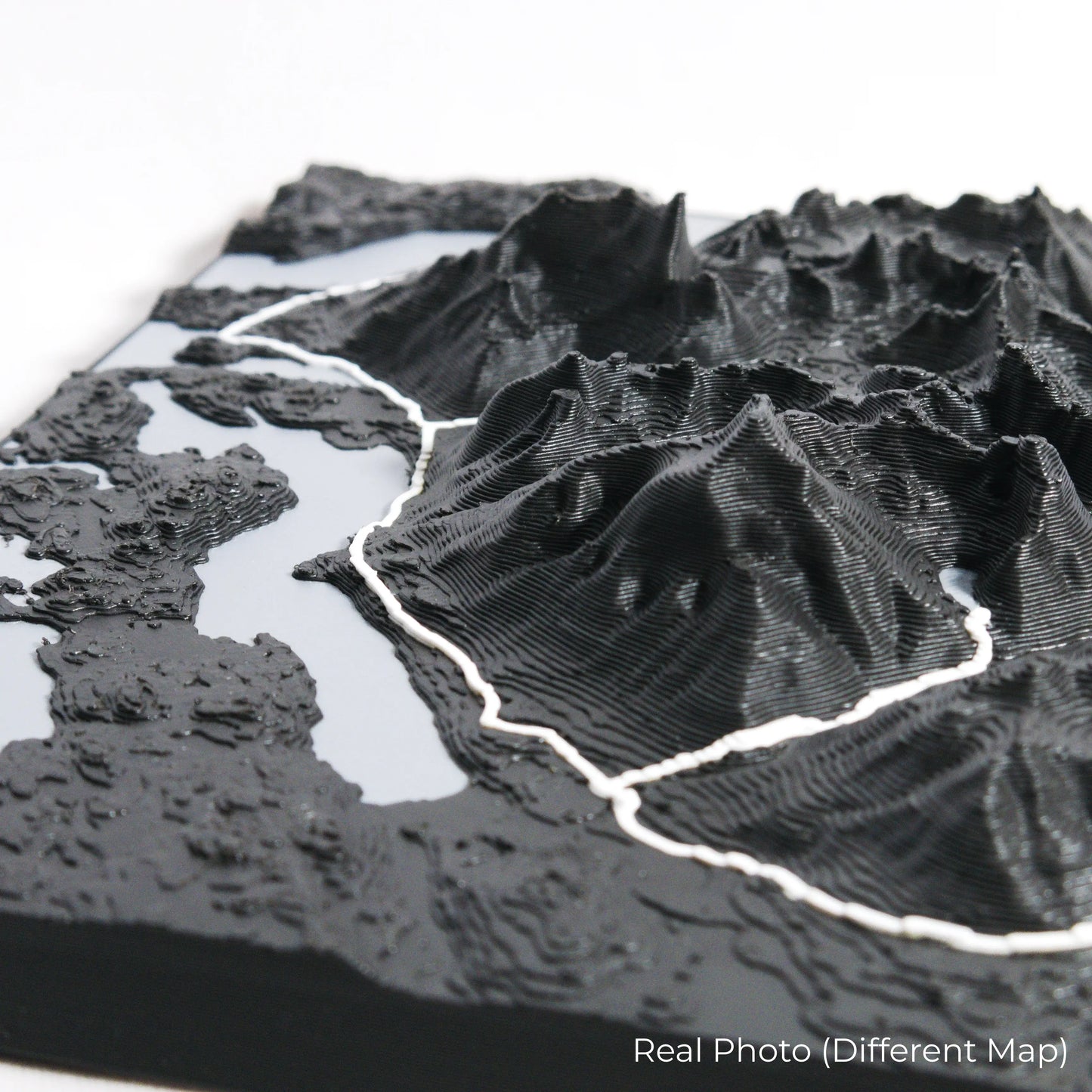
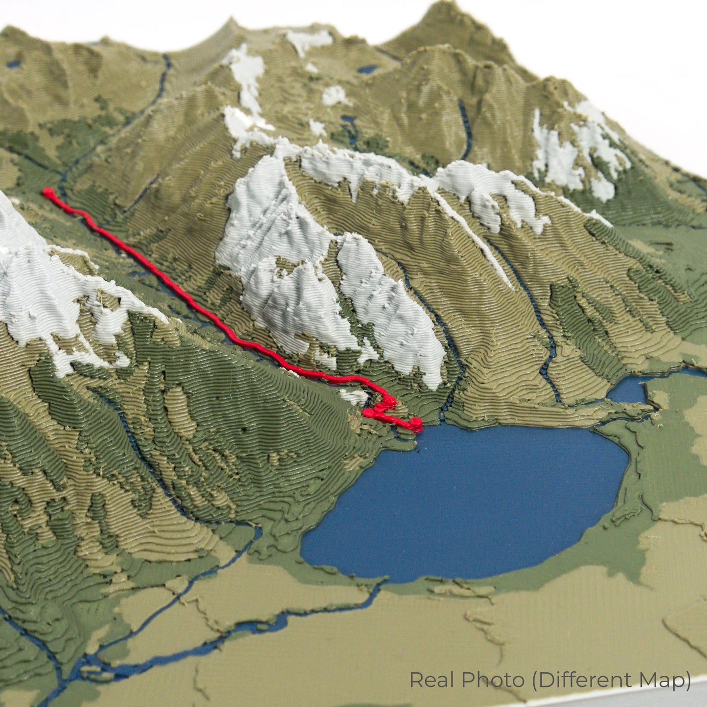
Crafted with Care and Precision
Our maps are meticulously designed using advanced colour 3D printing technology and PLA, a durable and plant-based plastic.
Please Note: Some product photos are digitally rendered for illustrative purposes and are labelled as "Rendered Image" for clarity. The actual product may show slight variations and natural imperfections due to the 3D printing process and material properties.
Bring the Highlands Home
Celebrate your love for Scotland’s wild landscapes with this one-of-a-kind keepsake. Whether you're reminiscing about past treks or planning your next Highland adventure, this 3D map is a tribute to the breathtaking beauty of the Rob Roy Way.
Order now and let us create a memento as unforgettable as your journey!
Data Sources
Our maps are created using high-precision topographic data from the following sources:
OpenStreetMap: openstreetmap.org/copyright
Copernicus WorldDEM-30: Produced using Copernicus WorldDEM-30 © DLR e.V. 2010-2014 and © Airbus Defence and Space GmbH 2014-2018, provided under COPERNICUS by the European Union and ESA; all rights reserved.
Share