Mapped3D 3D Printed Maps Auckland, New Zealand
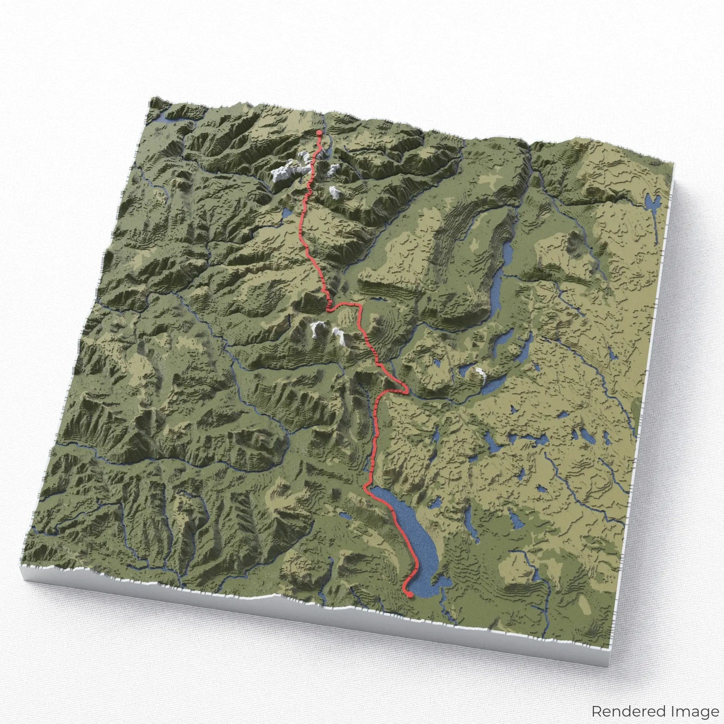
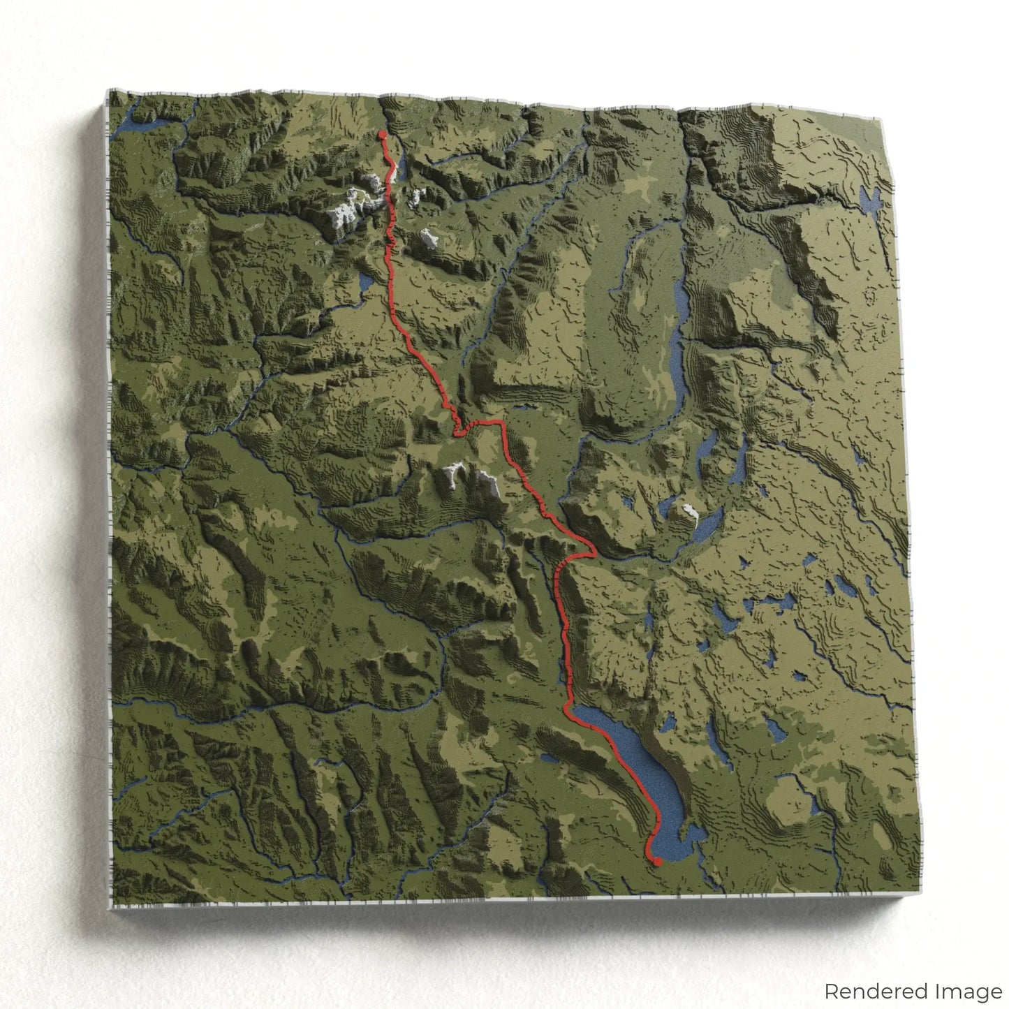
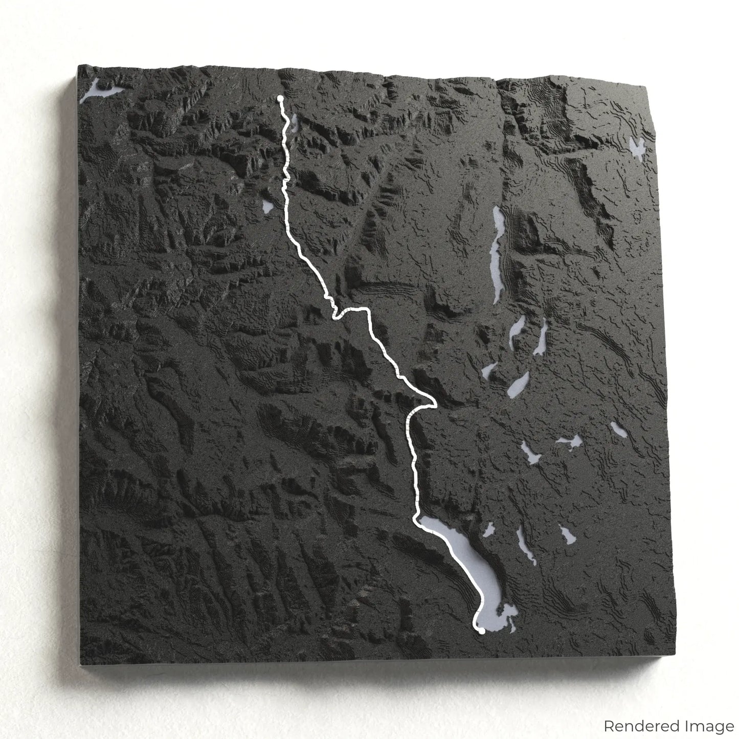
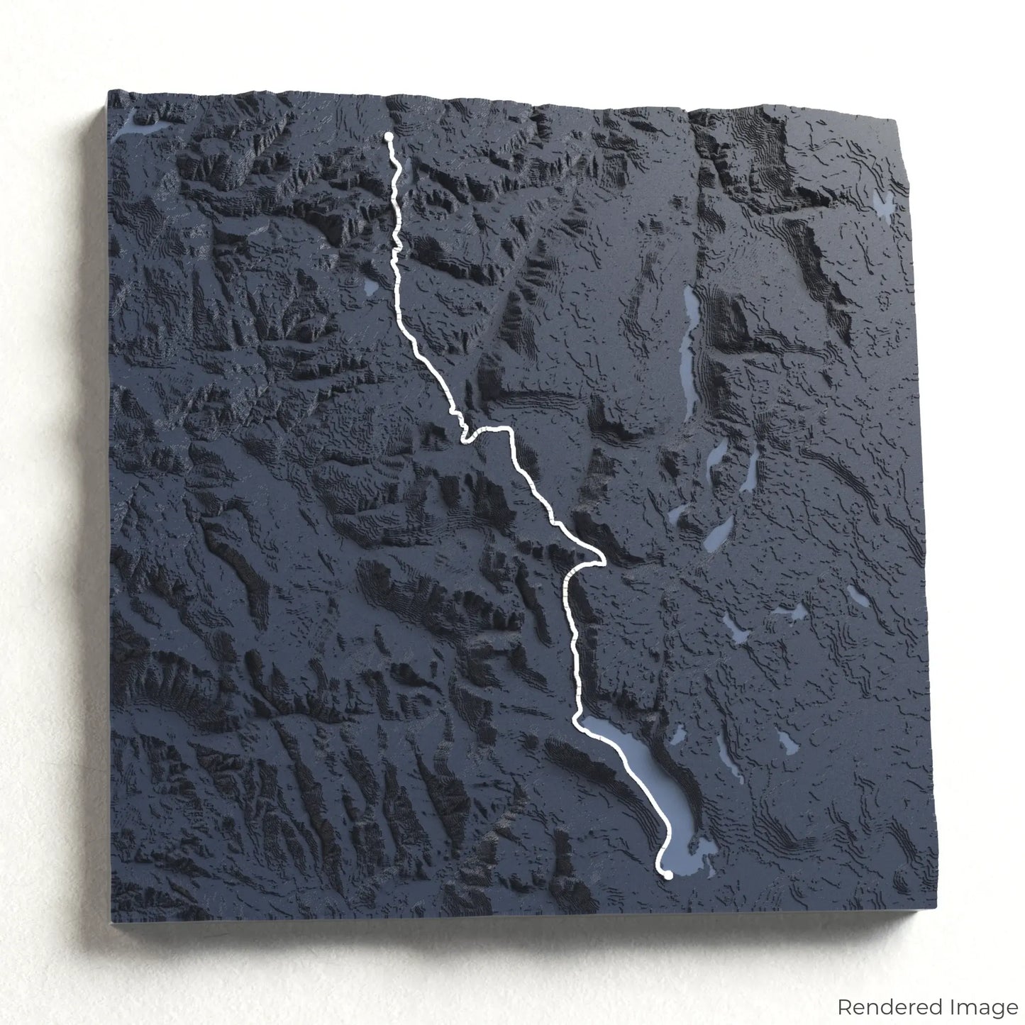
Overland Track 3D Map
Overland Track 3D Map
ORDERS NOT SHIPPED TILL SEPTEMBER!!!
Couldn't load pickup availability
Traverse the Wilderness of the Overland Track
Immerse yourself in the rugged beauty of Tasmania with our 3D topographic map of the Overland Track. This world-renowned trek takes you through dramatic mountain peaks, glacial lakes, and ancient rainforests in the heart of the Tasmanian Wilderness World Heritage Area.
A Journey Through Tasmania’s Wild Heart
The Overland Track spans approximately 65 kilometres (40 miles), leading hikers from Cradle Mountain to Lake St Clair. Along the way, adventurers encounter breathtaking alpine landscapes, cascading waterfalls, and the opportunity to summit Tasmania’s highest peak, Mount Ossa. Whether you've conquered this epic trail or dream of exploring it, our handcrafted map captures the essence of the Overland Track.
Create a Lasting Memory of Your Adventure
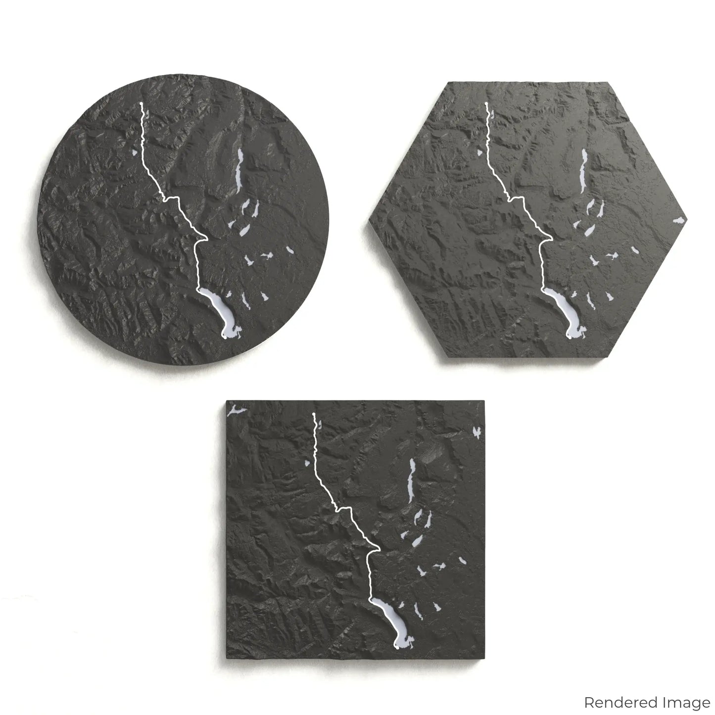
Choose from four striking colour themes and three unique shapes to create a stunning centrepiece for your wall or table. This handcrafted map is the perfect way to celebrate your Overland Track journey or as a meaningful gift for fellow nature lovers.
Select the Perfect Size and Shape
Circle: 222 x 222 x 19mm (8.7 x 8.7 x 0.7 inches)
Hexagon: 242 x 212 x 19mm (9.5 x 8.3 x 0.7 inches)
Square: 198 x 198 x 19mm (7.8 x 7.8 x 0.7 inches)
Crafted for Detail and Durability
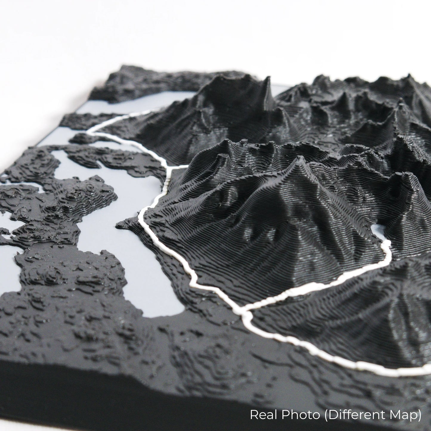
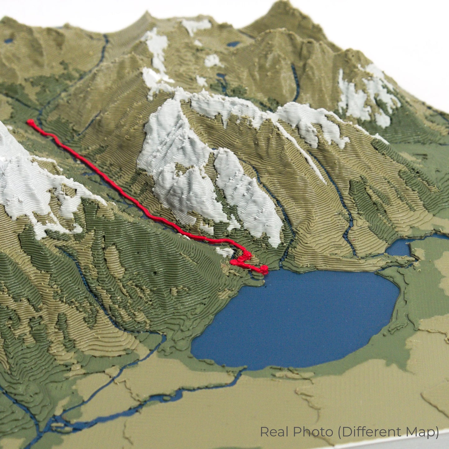
Our maps are meticulously designed using advanced colour 3D printing technology and PLA, a durable and plant-based plastic.
Please Note: Some product photos are digitally rendered for illustrative purposes and are labelled as "Rendered Image" for clarity. The actual product may show slight variations and natural imperfections due to the 3D printing process and material properties.
Bring Tasmania’s Wilderness Home
Celebrate your love for Australia’s wild landscapes with this one-of-a-kind keepsake. Whether you're reminiscing about past treks or planning your next great adventure, this 3D map is a tribute to the breathtaking beauty of the Overland Track.
Order now and let us create a memento as unforgettable as your journey!
Data Sources
Our maps are created using high-precision topographic data from the following sources:
OpenStreetMap: openstreetmap.org/copyright
Copernicus WorldDEM-30: Produced using Copernicus WorldDEM-30 © DLR e.V. 2010-2014 and © Airbus Defence and Space GmbH 2014-2018, provided under COPERNICUS by the European Union and ESA; all rights reserved.
Share