Summit the Legendary Mount Whitney Trail
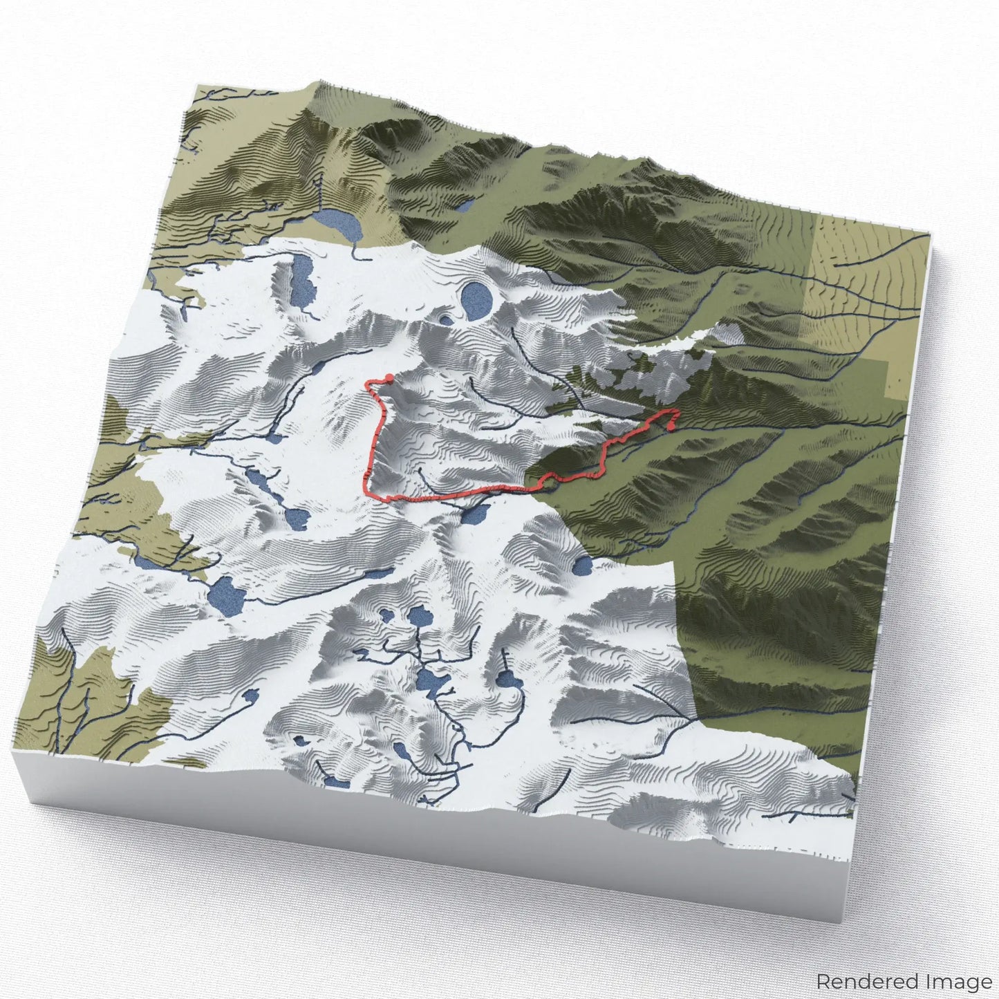
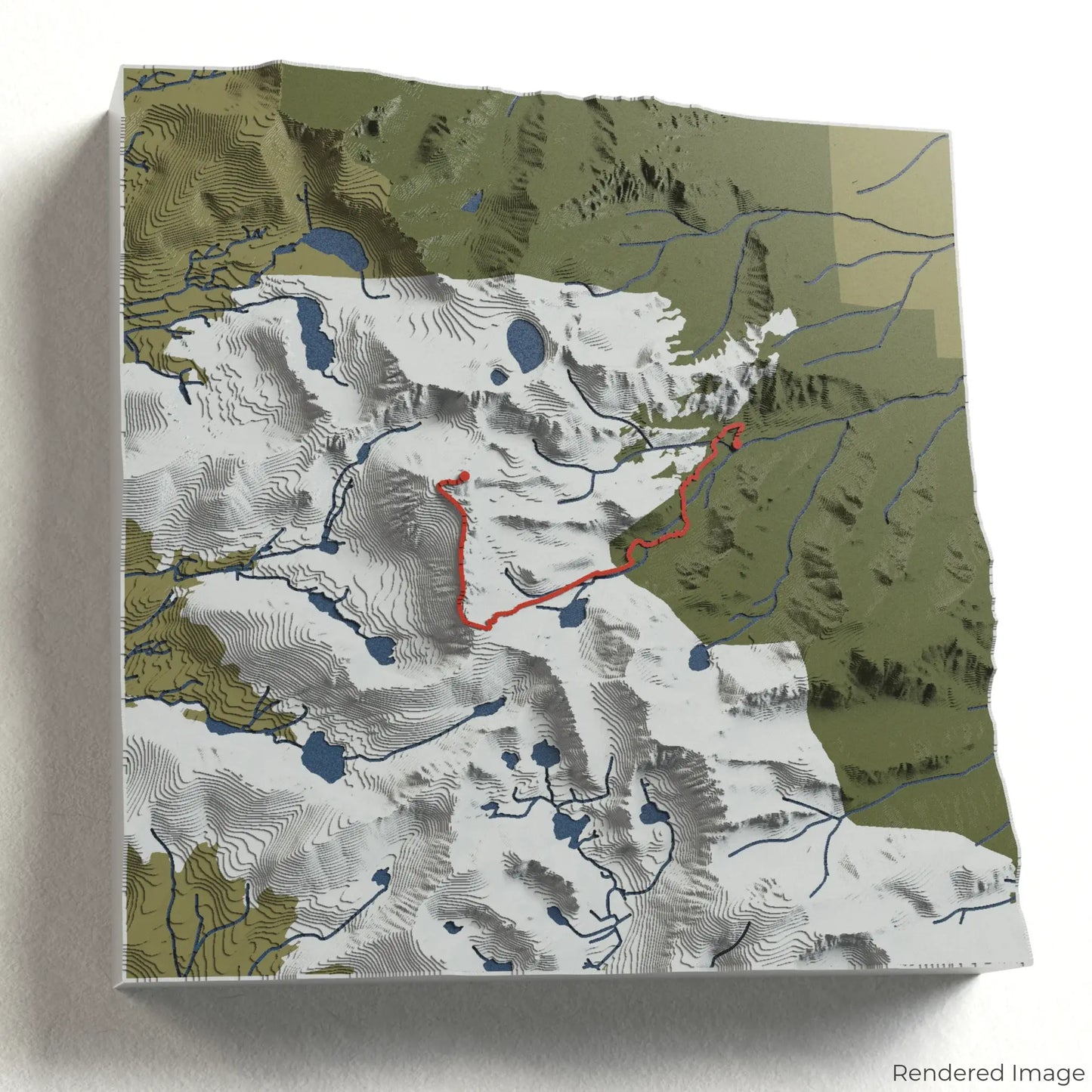
Embark on the ultimate high-altitude challenge with our 3D topographic map of the Mount Whitney Trail. This iconic trek leads to the highest peak in the contiguous United States, offering breathtaking alpine landscapes and a rewarding ascent.
A Journey to California’s Highest Summit
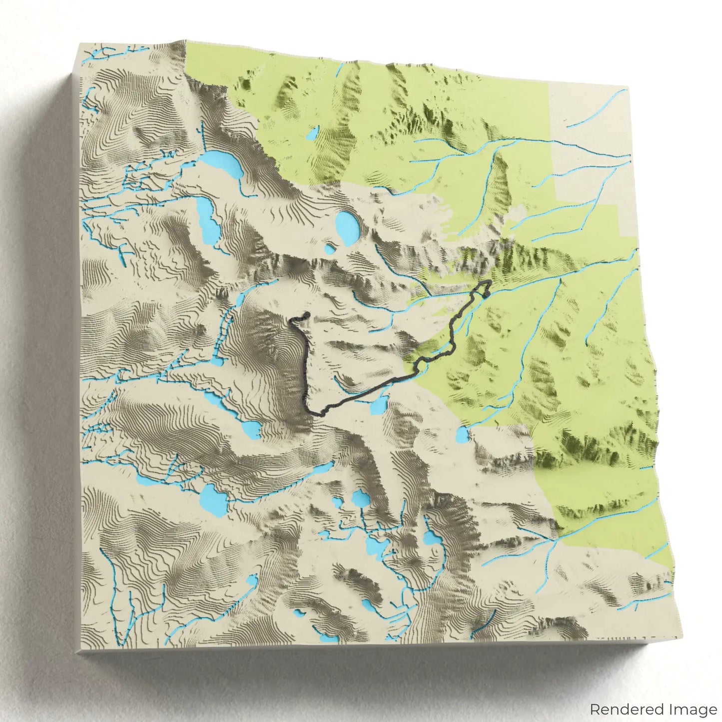
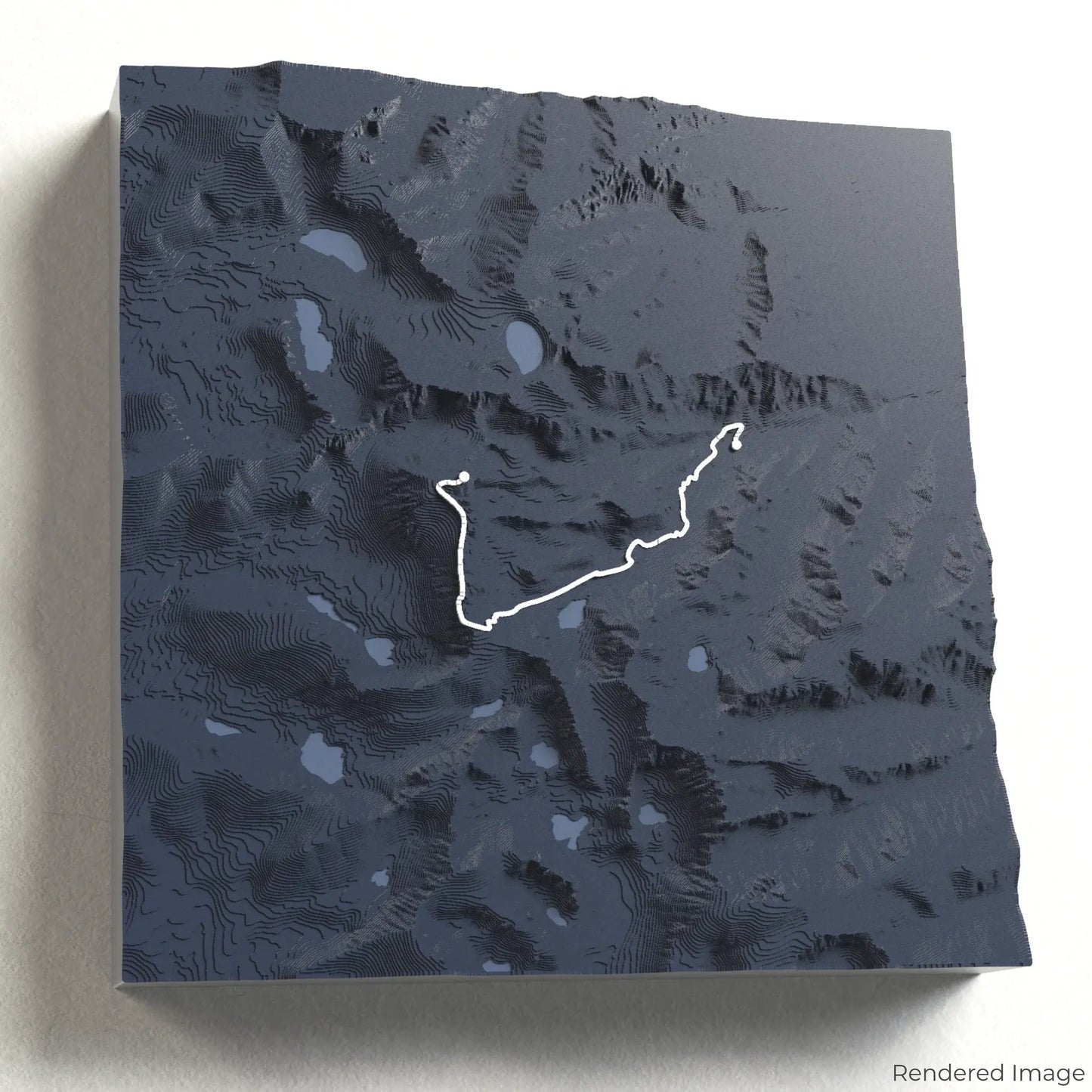
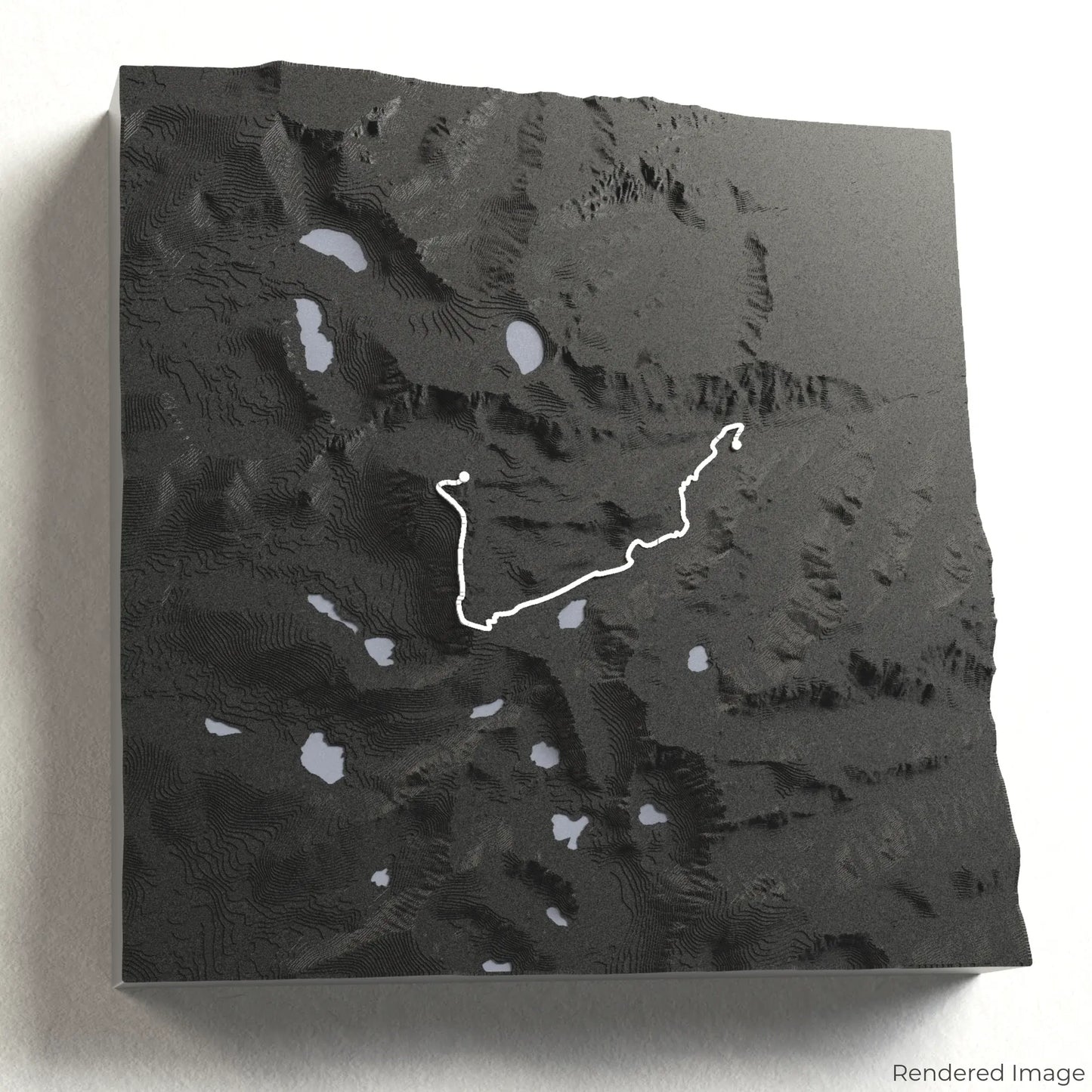
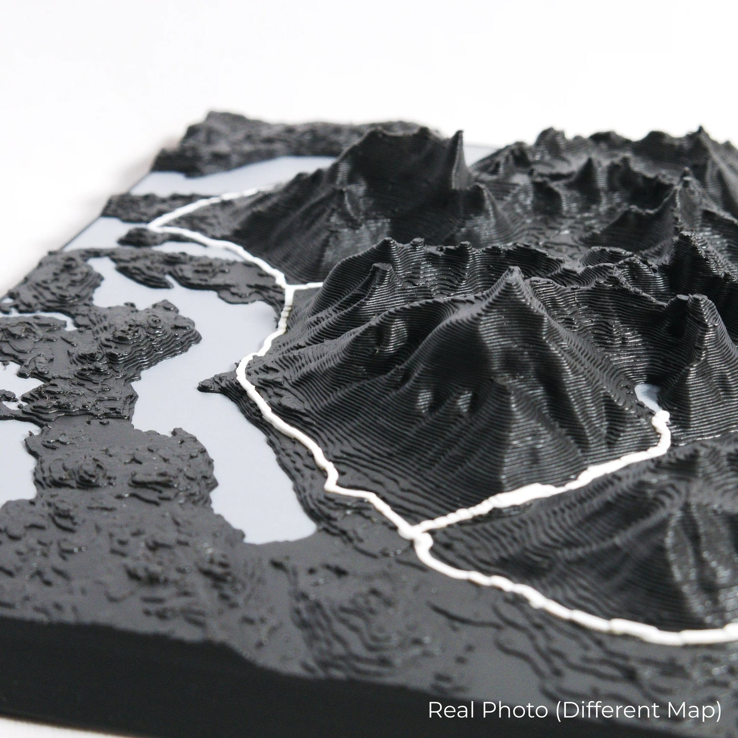
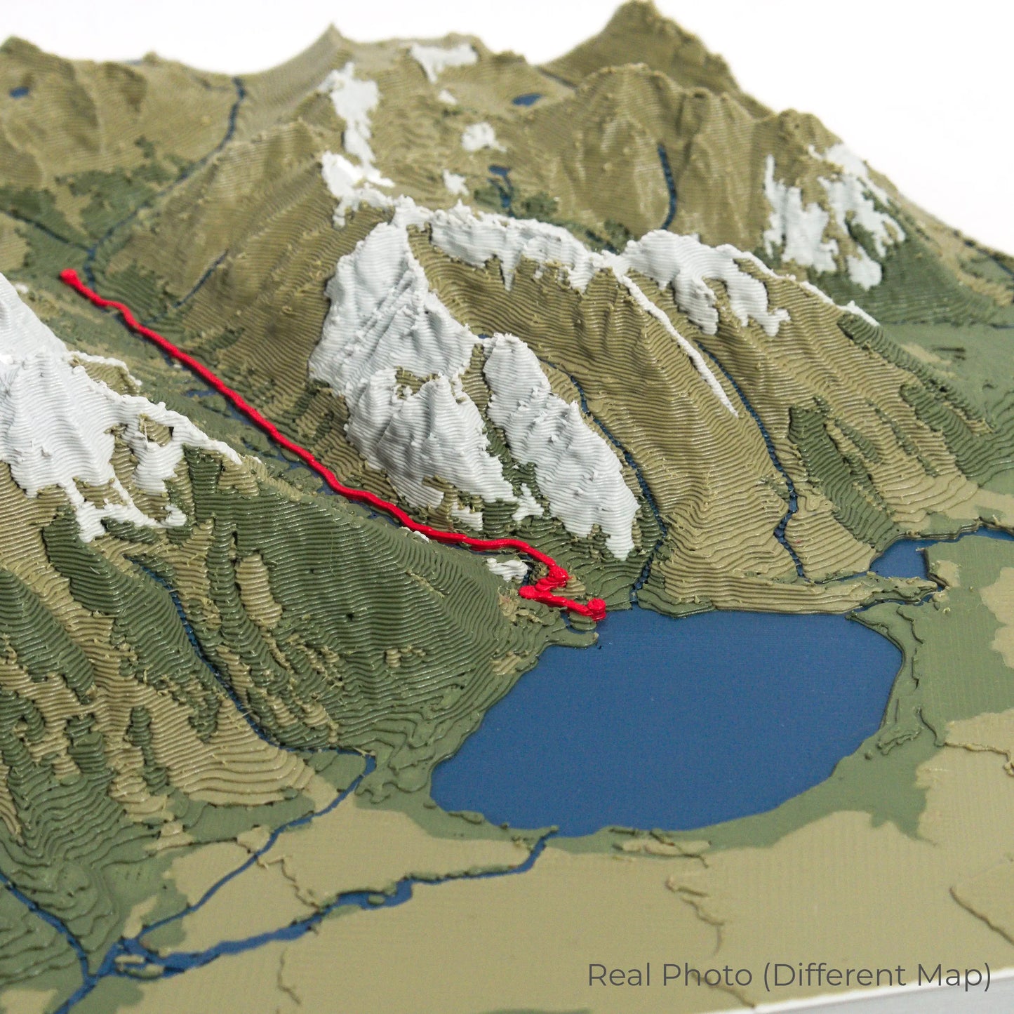
The Mount Whitney Trail stretches approximately 35 kilometres (22 miles) round trip, climbing to an elevation of 4,421 metres (14,505 feet). Hikers traverse rugged granite switchbacks, cross pristine alpine meadows, and navigate the famous 99 Switchbacks before reaching the summit. Whether you've completed this epic climb or dream of standing atop Mount Whitney, our handcrafted map captures the essence of this iconic trail.
Customise Your Summit Keepsake
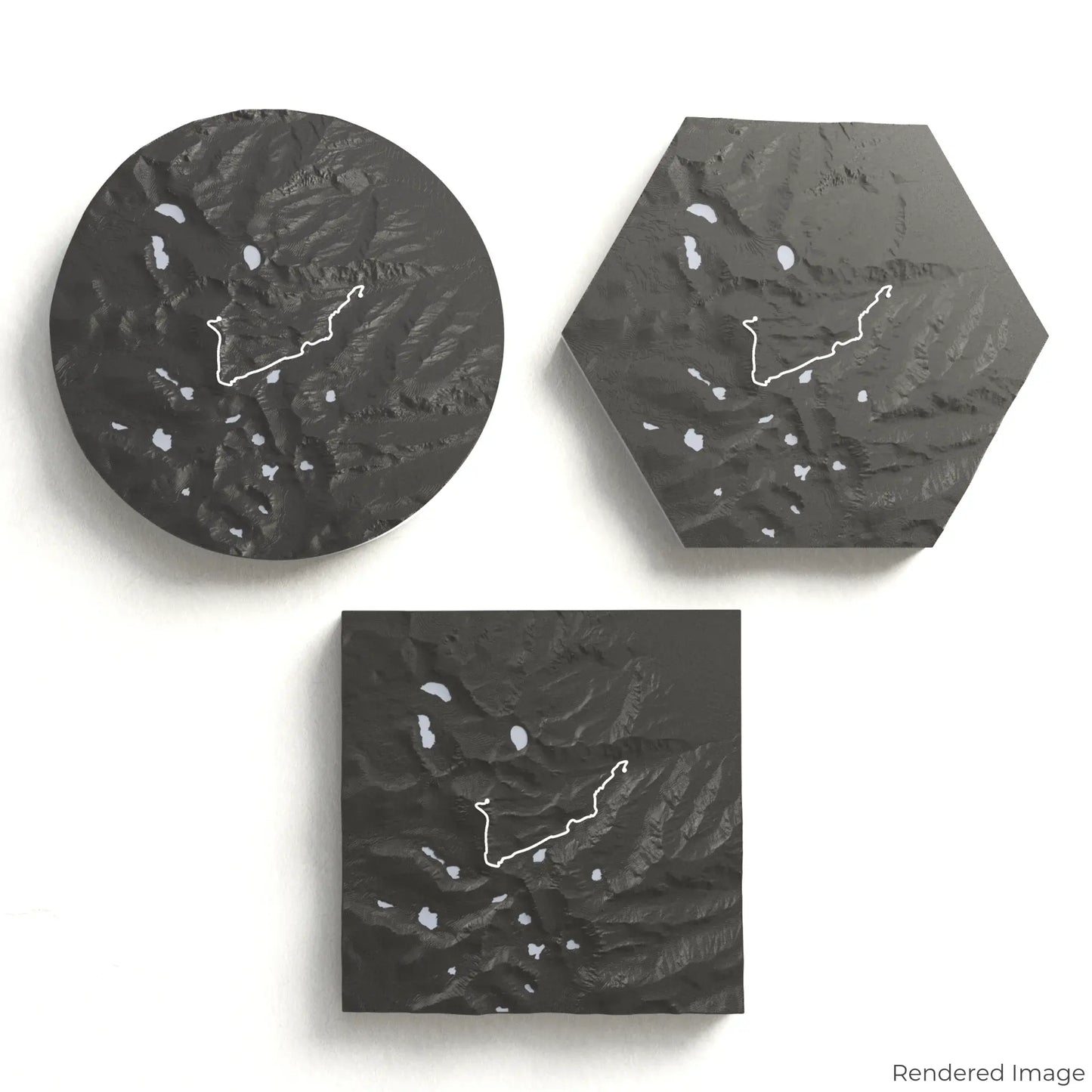
Choose from four striking colour themes and three unique shapes to create a stunning centrepiece for your wall or table. This handcrafted map is the perfect way to commemorate your Mount Whitney adventure or as a meaningful gift for fellow climbers.
Select the Perfect Fit for Your Space
Circle: 222 x 222 x 43mm (8.7 x 8.7 x 1.7 inches)
Hexagon: 242 x 212 x 43mm (9.5 x 8.3 x 1.7 inches)
Square: 198 x 198 x 44mm (7.8 x 7.8 x 1.7 inches)
Crafted for Detail and Durability
Our maps are meticulously designed using advanced colour 3D printing technology and PLA, a durable and plant-based plastic.
Please Note: Some product photos are digitally rendered for illustrative purposes and are labelled as "Rendered Image" for clarity. The actual product may show slight variations and natural imperfections due to the 3D printing process and material properties.
Bring the Sierra Nevada Home
Celebrate your love for California’s iconic peaks with this one-of-a-kind keepsake. Whether you're reminiscing about past climbs or preparing for your next high-altitude adventure, this 3D map is a tribute to the beauty of the Mount Whitney Trail.
Order now and let us create a memento as unforgettable as your journey!
Data Sources
Our maps are created using high-precision topographic data from the following sources:
OpenStreetMap: openstreetmap.org/copyright
Copernicus WorldDEM-30: Produced using Copernicus WorldDEM-30 © DLR e.V. 2010-2014 and © Airbus Defence and Space GmbH 2014-2018, provided under COPERNICUS by the European Union and ESA; all rights reserved.