Mapped3D 3D Printed Maps Auckland, New Zealand
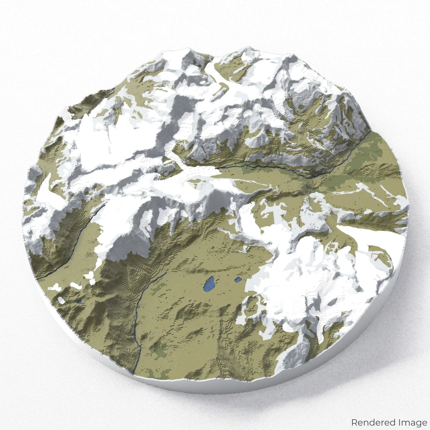
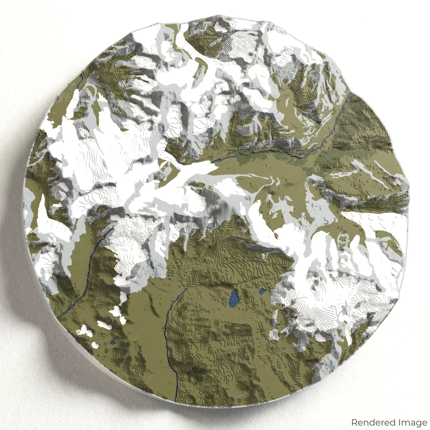
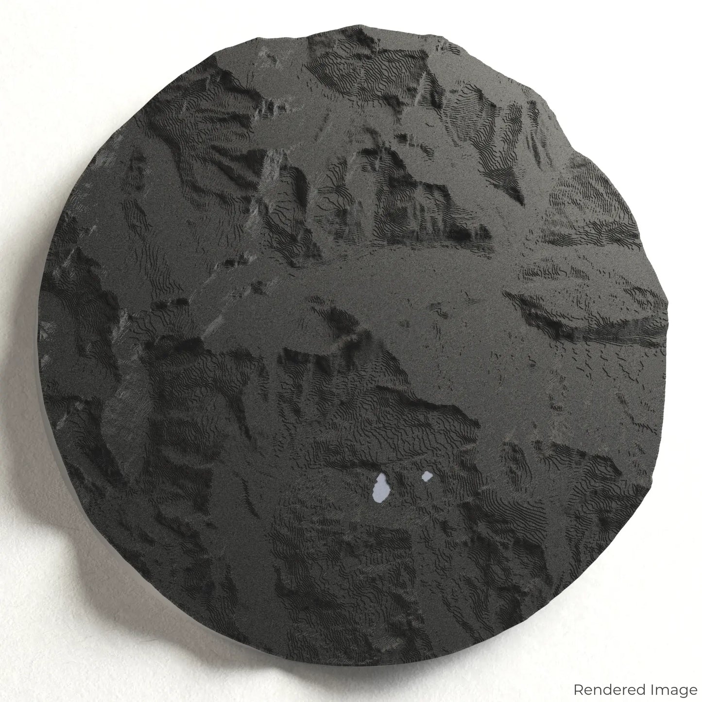
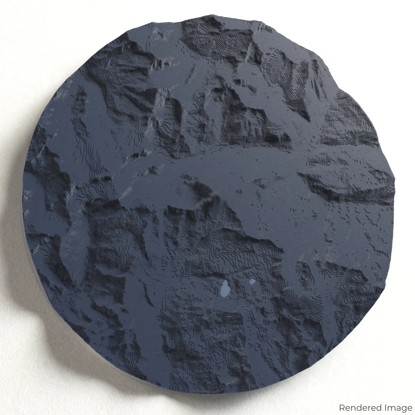
Matterhorn 3D Map
Matterhorn 3D Map
ORDERS NOT SHIPPED TILL SEPTEMBER!!!
Couldn't load pickup availability
Experience the Iconic Matterhorn
Celebrate one of the most recognizable peaks in the world with our 3D topographic map of the Matterhorn. This legendary mountain, standing at 4,478 metres (14,692 feet), is a symbol of adventure, challenge, and alpine beauty.
A Landmark of the Swiss Alps
The Matterhorn dominates the skyline between Switzerland and Italy, with its dramatic pyramid shape attracting climbers and admirers from around the world. From the picturesque village of Zermatt to the breathtaking Hörnli Ridge, this iconic peak is both a mountaineering challenge and a marvel of nature. Whether you've summited the Matterhorn or dream of witnessing its grandeur, our handcrafted map captures its unmistakable form.
Personalise Your Alpine Keepsake
Choose from four striking colour themes and three unique shapes to create a stunning centrepiece for your wall or table. This handcrafted map is the perfect way to commemorate your connection to the Matterhorn or as a thoughtful gift for fellow adventurers.
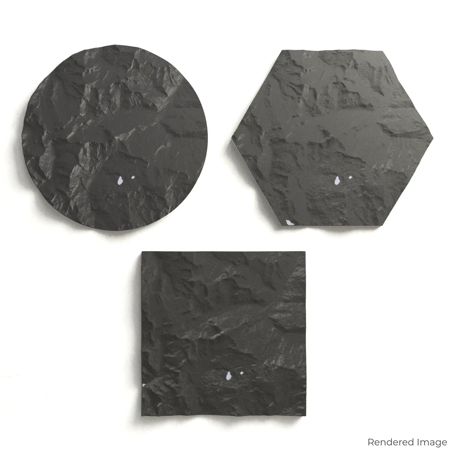
Select the Perfect Size and Shape
Circle: 222 x 222 x 32 mm (8.7 x 8.7 x 1.3 inches)
Hexagon: 242 x 212 x 32 mm (9.5 x 8.3 x 1.3 inches)
Square: 198 x 198 x 32 mm (7.8 x 7.8 x 1.3 inches)
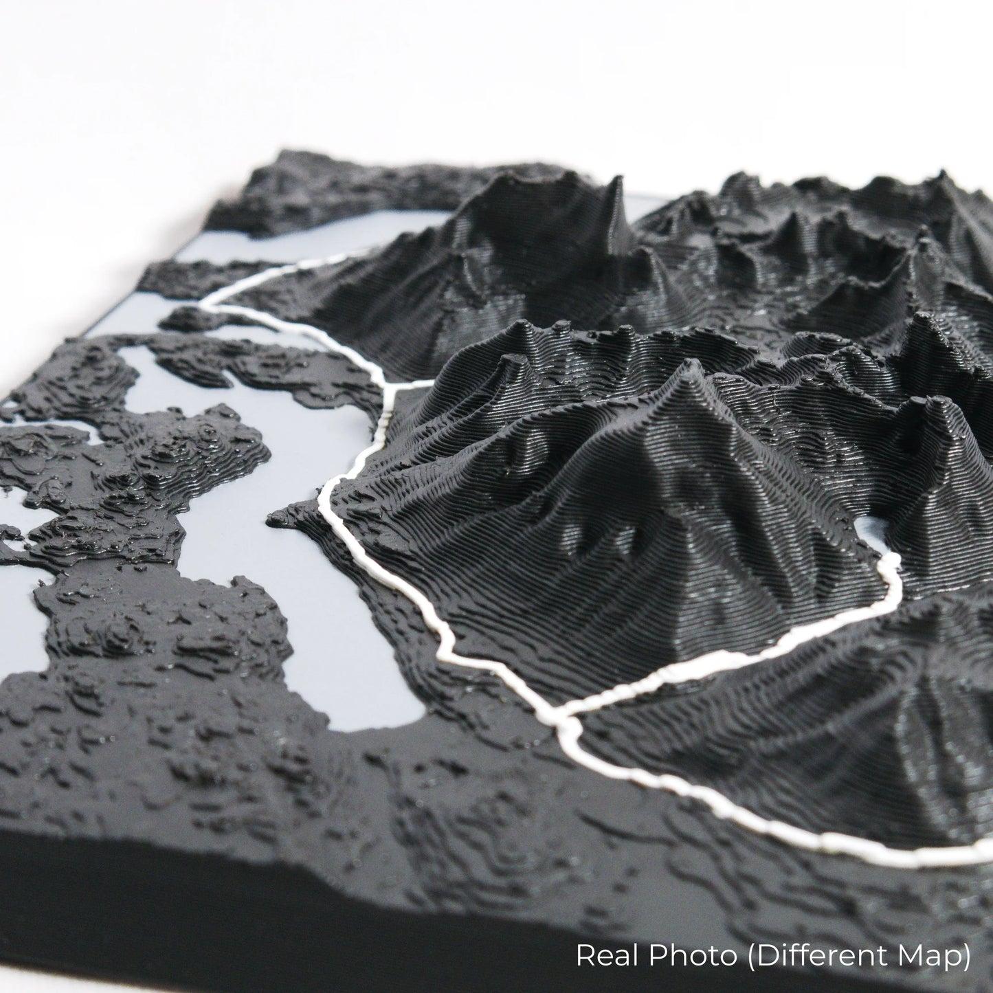
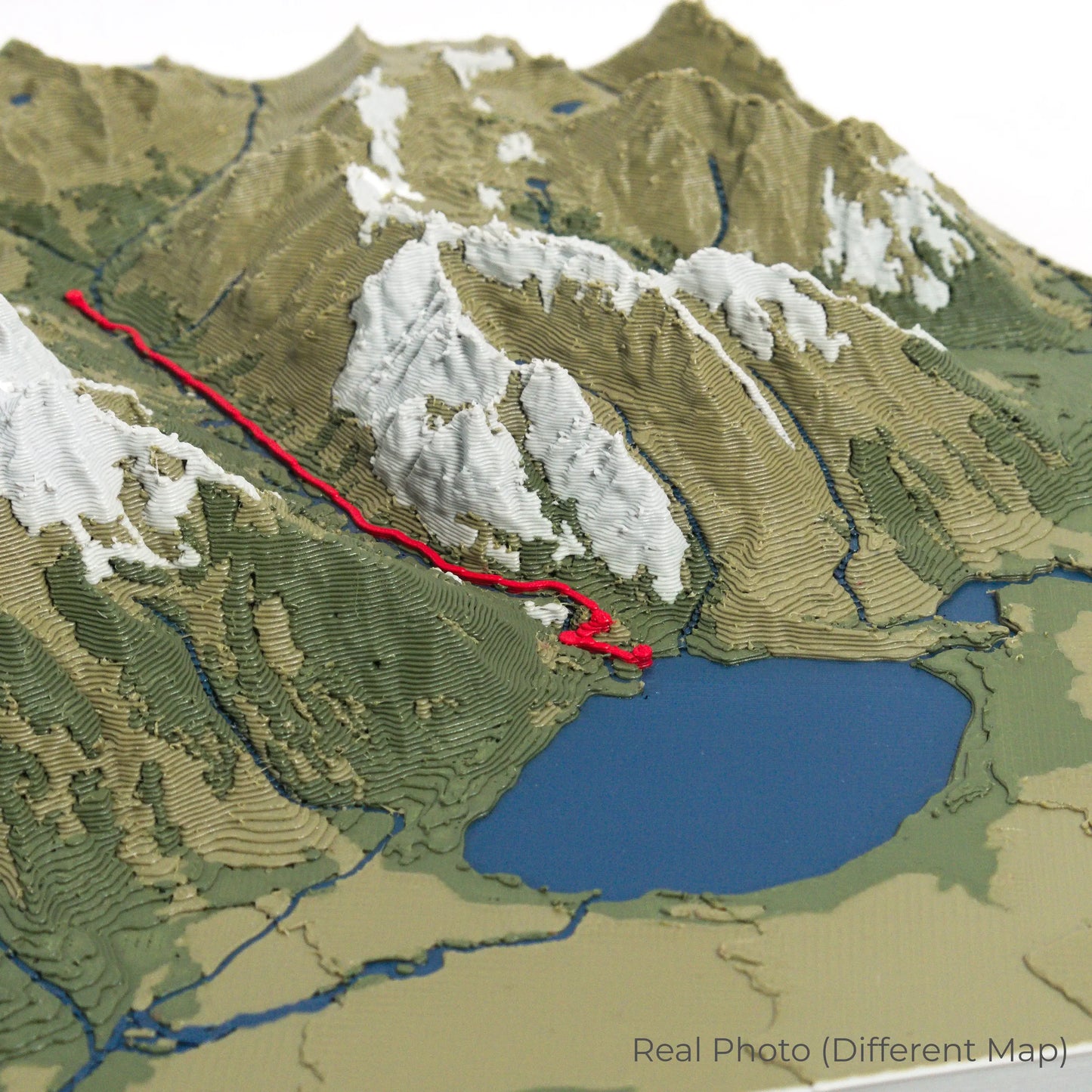
Crafted with Precision and Detail
Our maps are meticulously designed using advanced colour 3D printing technology and PLA, a durable and plant-based plastic.
Please Note: Some product photos are digitally rendered for illustrative purposes and are labelled as "Rendered Image" for clarity. The actual product may show slight variations and natural imperfections due to the 3D printing process and material properties.
Bring the Alps Home
Celebrate your passion for mountaineering and the beauty of the Swiss Alps with this one-of-a-kind keepsake. Whether you're reminiscing about past climbs or simply admiring the Matterhorn's majesty, this 3D map is a tribute to one of the world's greatest peaks.
Order now and let us create a memento as unforgettable as your journey!
Data Sources
Our maps are created using high-precision topographic data from the following sources:
OpenStreetMap: openstreetmap.org/copyright
Copernicus WorldDEM-30: Produced using Copernicus WorldDEM-30 © DLR e.V. 2010-2014 and © Airbus Defence and Space GmbH 2014-2018, provided under COPERNICUS by the European Union and ESA; all rights reserved.
Share