Mapped3D 3D Printed Maps Auckland, New Zealand
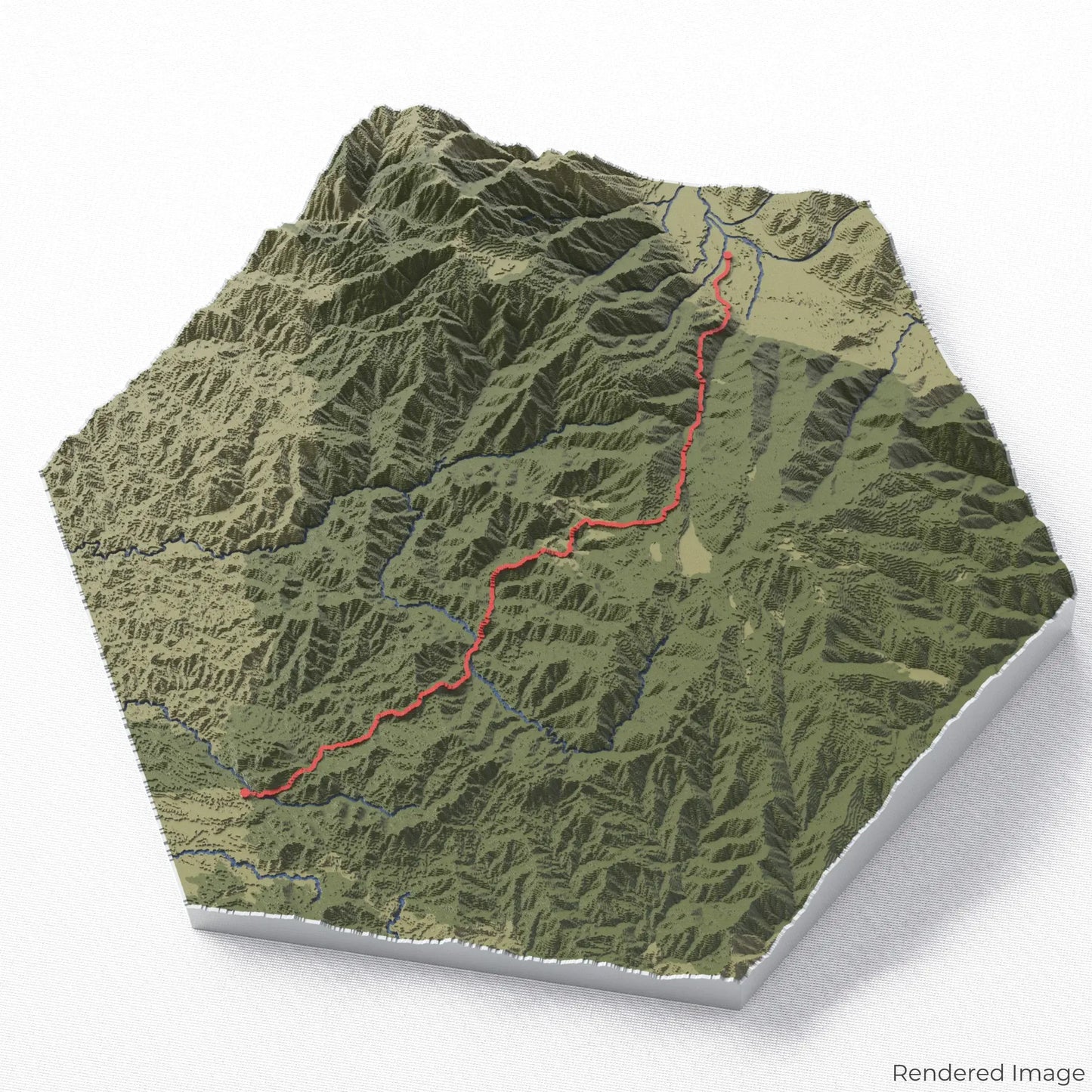
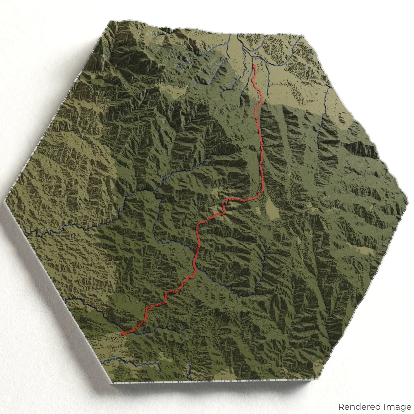
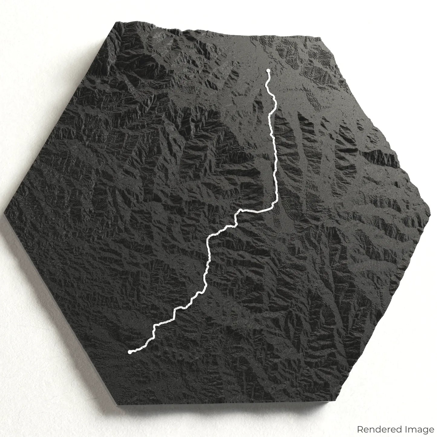
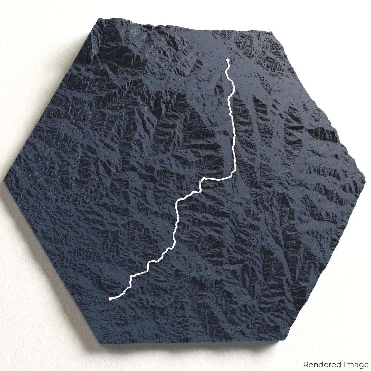
Kokoda Track 3D Map
Kokoda Track 3D Map
ORDERS NOT SHIPPED TILL SEPTEMBER!!!
Couldn't load pickup availability
Discover the Kokoda Track
Experience the historic and rugged beauty of Papua New Guinea with our 3D topographic map of the Kokoda Track. This challenging trail is steeped in history and natural splendour, making it a must for adventurers and history enthusiasts alike.
A Path Through History and Wilderness
The Kokoda Track spans approximately 96 kilometres (60 miles), guiding trekkers through dense rainforests, across swift rivers, and over mountainous terrain. This iconic trail was the site of a pivotal World War II campaign, and today it serves as both a historical journey and a physical challenge. Whether you've completed the trek or dream of walking in the footsteps of history, our handcrafted map captures the essence of the Kokoda Track.
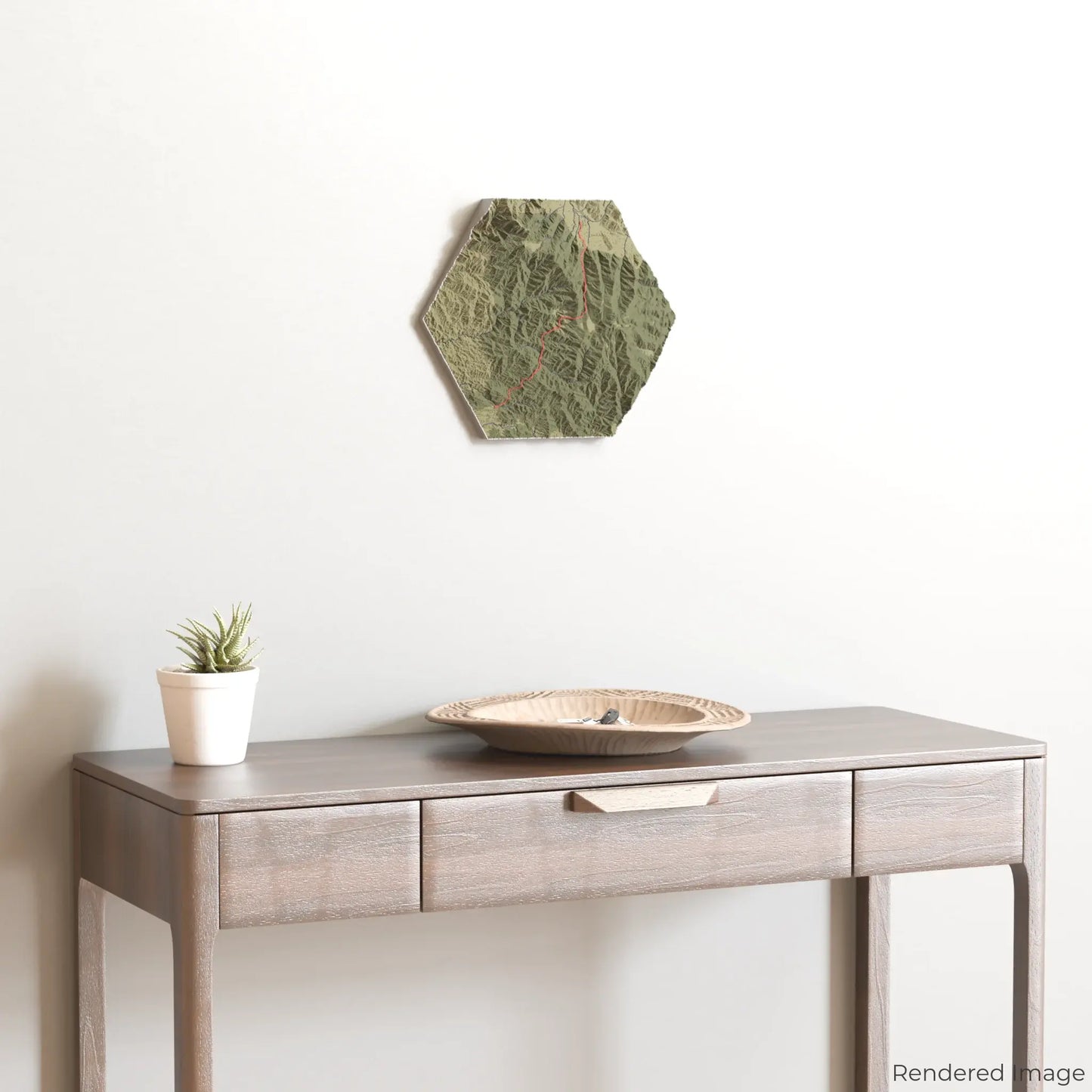
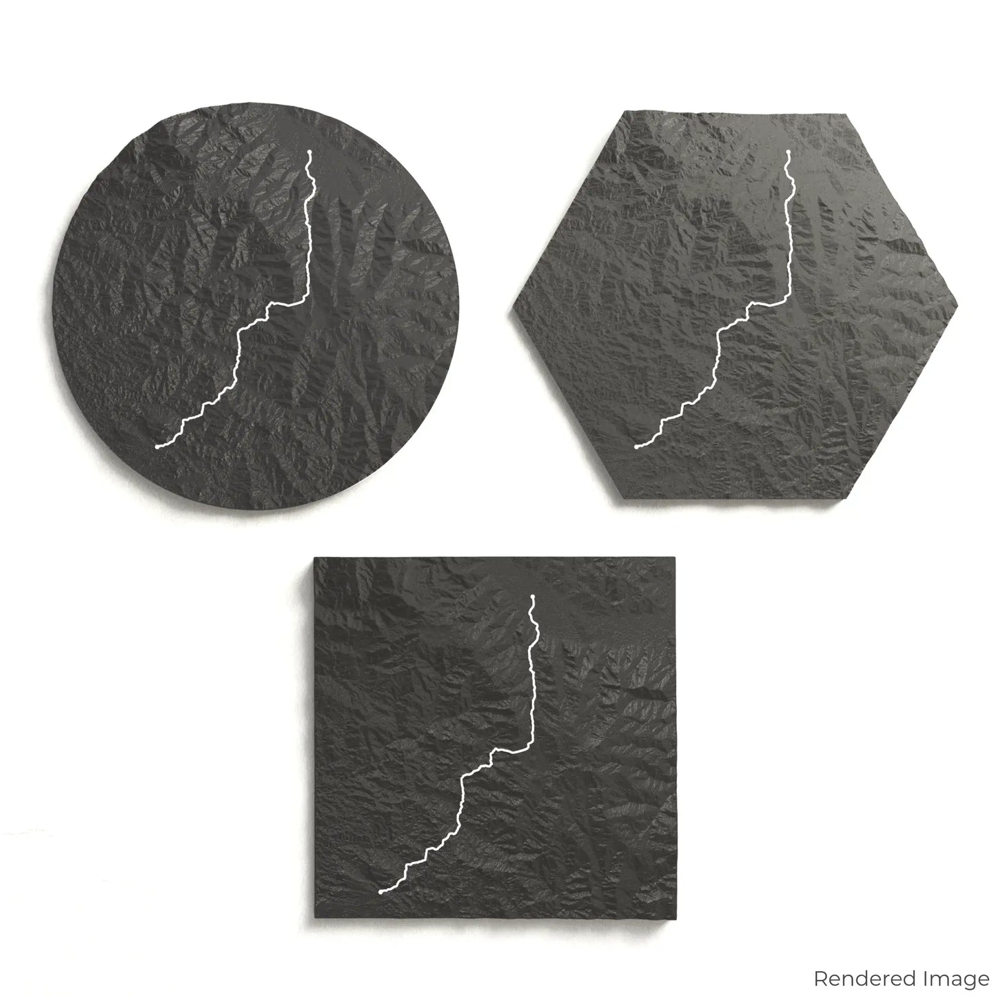
Personalise Your Trail Map
Choose from four striking colour themes and three unique shapes to create an eye-catching centrepiece for your wall or table. This handcrafted map is the perfect way to commemorate your journey along the Kokoda Track or as a thoughtful gift for fellow explorers.
Available Sizes and Shapes
Circle: 222 x 222 x 32 mm (8.7 x 8.7 x 1.2 inches)
Hexagon: 242 x 212 x 32 mm (9.5 x 8.3 x 1.2 inches)
Square: 198 x 198 x 32 mm (7.8 x 7.8 x 1.2 inches)
Precision Craftsmanship
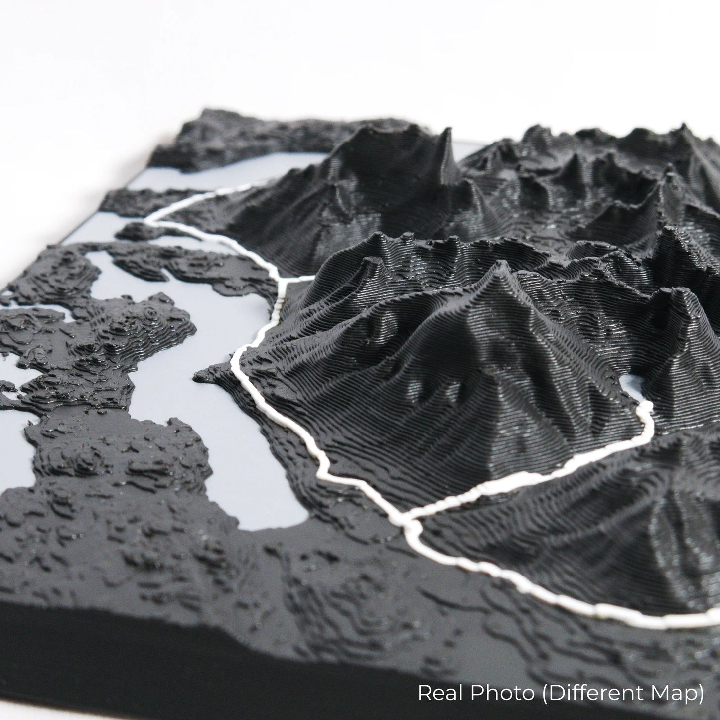
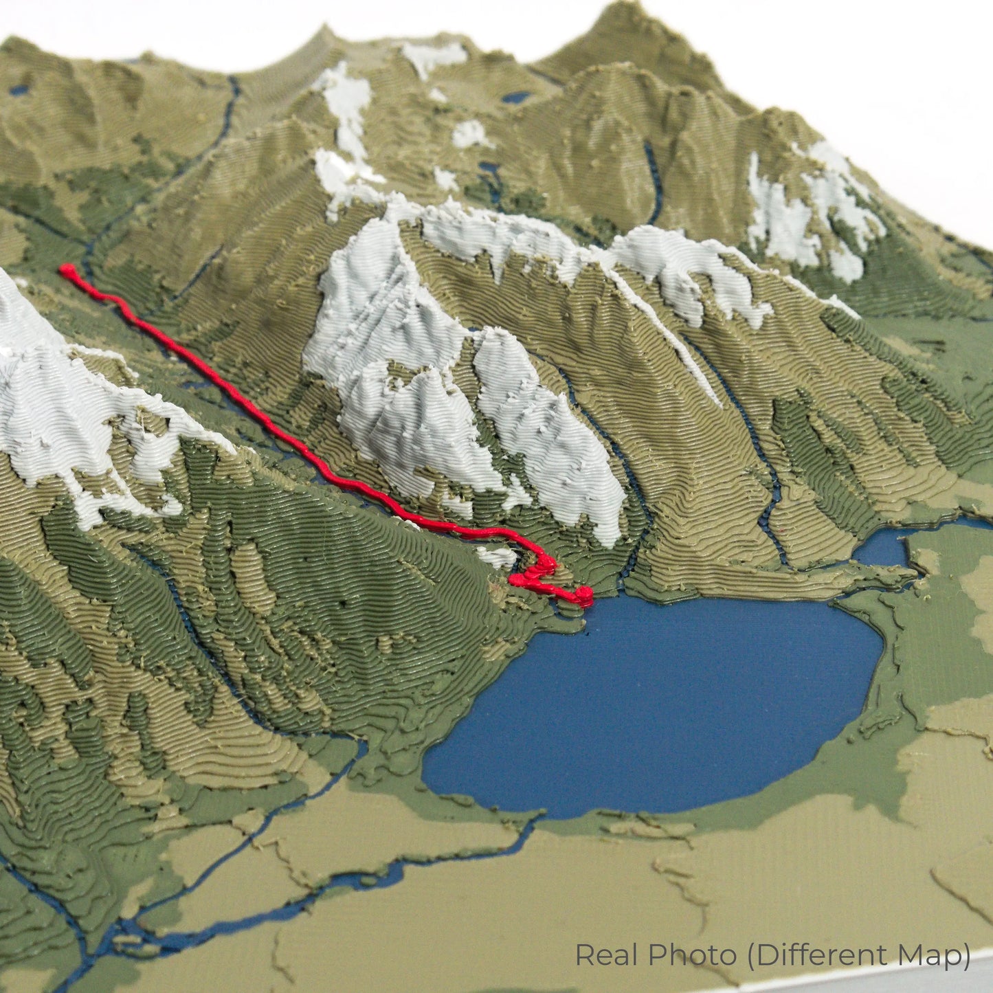
Our maps are meticulously crafted using advanced colour 3D printing technology and PLA, a durable and plant-based plastic.
Please Note: Some product photos are digitally rendered for illustrative purposes and are labelled as "Rendered Image" for clarity. The actual product may show slight variations and natural imperfections due to the 3D printing process and material properties.
Bring Papua New Guinea’s Heritage Home
Celebrate your love for history and adventure with this one-of-a-kind keepsake. Whether you're reliving cherished memories or planning your next expedition, this 3D map is a testament to the enduring spirit of the Kokoda Track.
Order now and let us create a memento as unforgettable as your journey!
Data Sources
Our maps are created using high-precision topographic data from the following sources:
OpenStreetMap: openstreetmap.org/copyright
Copernicus WorldDEM-30: Produced using Copernicus WorldDEM-30 © DLR e.V. 2010-2014 and © Airbus Defence and Space GmbH 2014-2018, provided under COPERNICUS by the European Union and ESA; all rights reserved.
Share