Mapped3D 3D Printed Maps Auckland, New Zealand
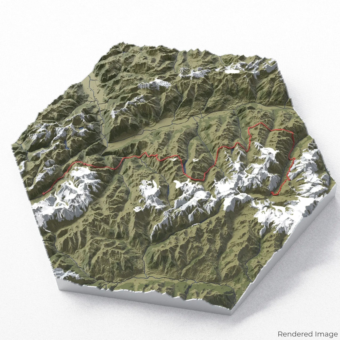
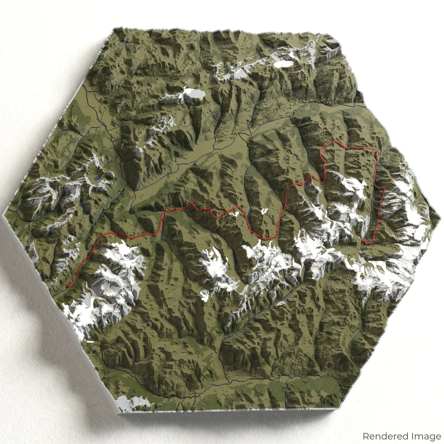
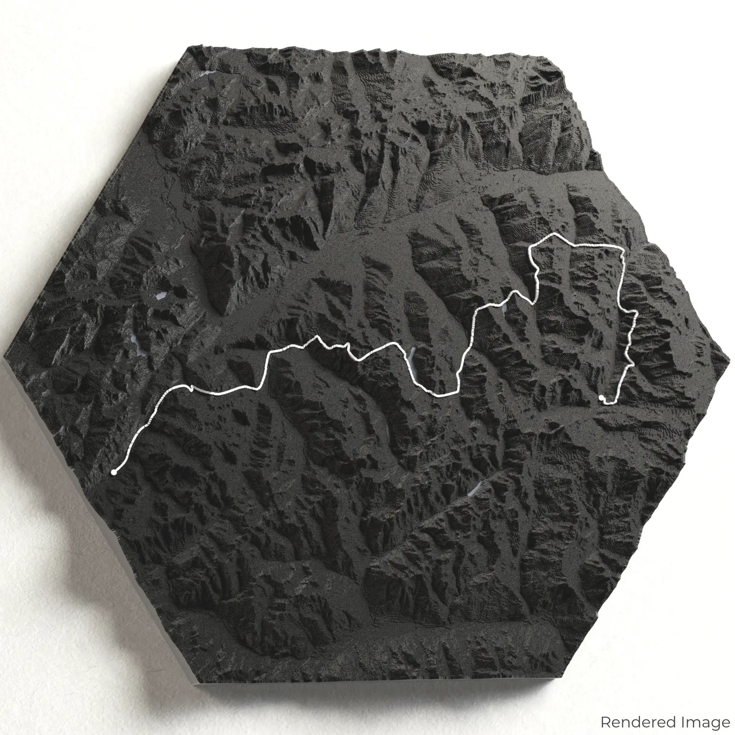
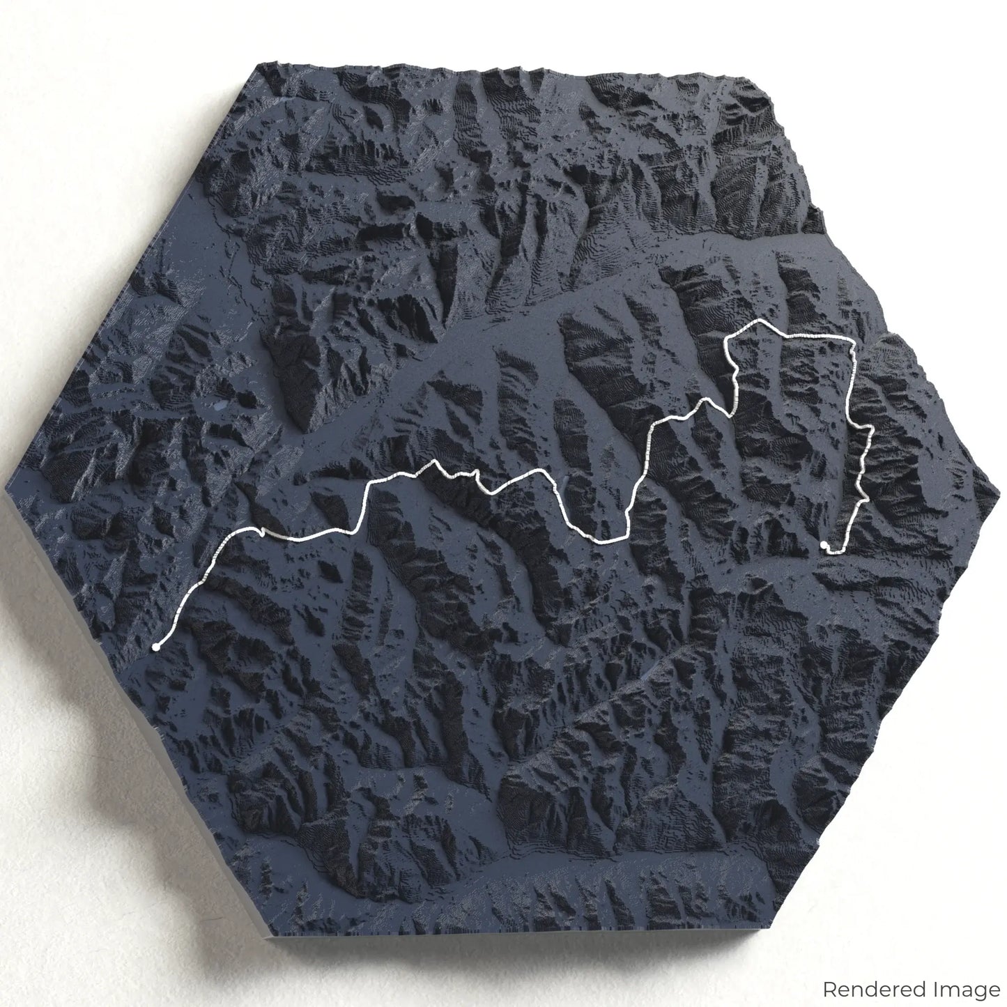
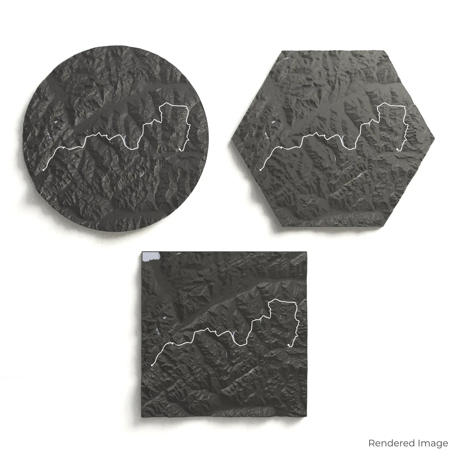
Haute Route 3D Map
Haute Route 3D Map
ORDERS NOT SHIPPED TILL SEPTEMBER!!!
Couldn't load pickup availability
Embark on the Haute Route
Discover the stunning beauty of the Alps with our 3D topographic map of the Haute Route. This world-renowned trail takes you through picturesque valleys, towering peaks, and glaciated landscapes, offering an unforgettable alpine adventure.
A Journey Through Alpine Majesty
The Haute Route covers approximately 180 kilometres (112 miles), guiding hikers from Chamonix in France to Zermatt in Switzerland. Along the way, you'll traverse high mountain passes, encounter breathtaking views of iconic peaks like Mont Blanc and the Matterhorn, and experience the timeless charm of alpine villages. Whether you've completed this epic trek or dream of doing so, our handcrafted map captures the essence of the Haute Route.
Custom Keepsakes to Cherish
Choose from four striking colour themes and three unique shapes to create an eye-catching centrepiece for your wall or table. This handcrafted map is the perfect way to commemorate your journey along the Haute Route or as a thoughtful gift for fellow explorers.
Available Sizes and Shapes
Circle: 222 x 222 x 22mm (8.7 x 8.7 x 0.9 inches)
Hexagon: 242 x 212 x 21mm (9.5 x 8.3 x 0.8 inches)
Square: 198 x 198 x 22mm (7.8 x 7.8 x 0.9 inches)
Unmatched Craftsmanship
Our maps are meticulously crafted using advanced colour 3D printing technology and PLA, a durable and plant-based plastic.
Please Note: Some product photos are digitally rendered for illustrative purposes and are labelled as "Rendered Image" for clarity. The actual product may show slight variations and natural imperfections due to the 3D printing process and material properties.
Bring the Alps Home
Celebrate your love for alpine adventures with this one-of-a-kind keepsake. Whether you're reliving cherished memories or planning your next trek, this 3D map is a testament to the breathtaking beauty of the Haute Route.
Order now and let us create a memento as unforgettable as your journey!
Data Sources
Our maps are created using high-precision topographic data from the following sources:
OpenStreetMap: openstreetmap.org/copyright
Copernicus WorldDEM-30: Produced using Copernicus WorldDEM-30 © DLR e.V. 2010-2014 and © Airbus Defence and Space GmbH 2014-2018, provided under COPERNICUS by the European Union and ESA; all rights reserved.
Share