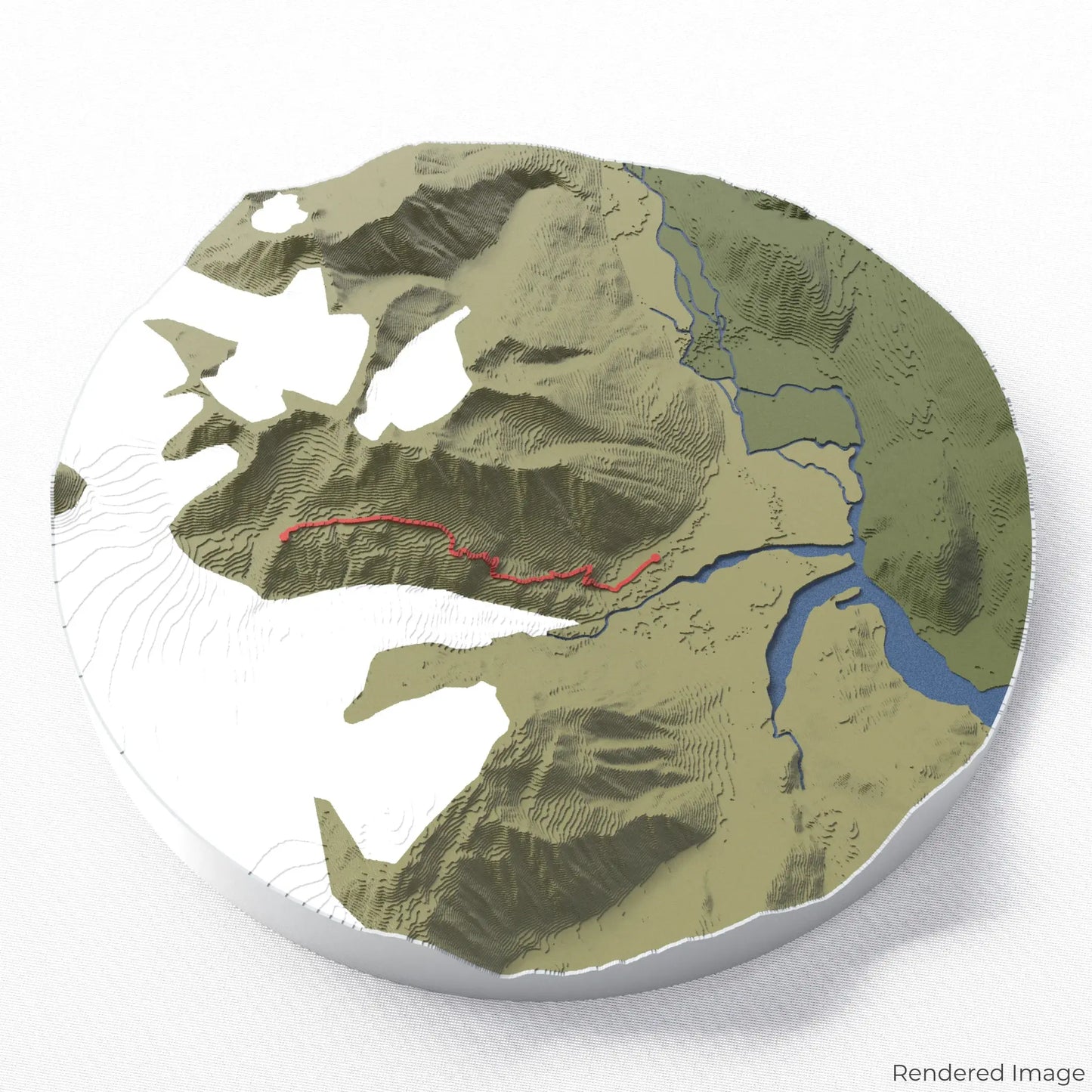
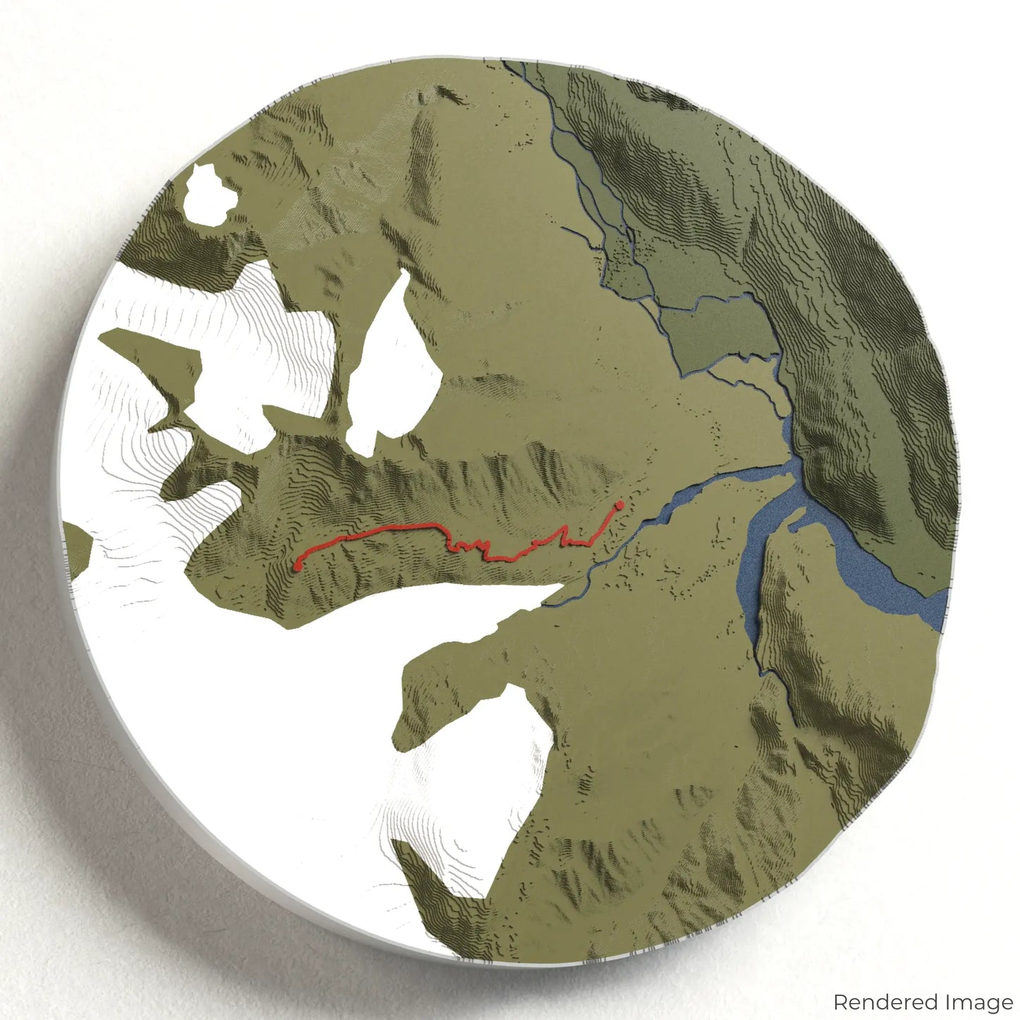
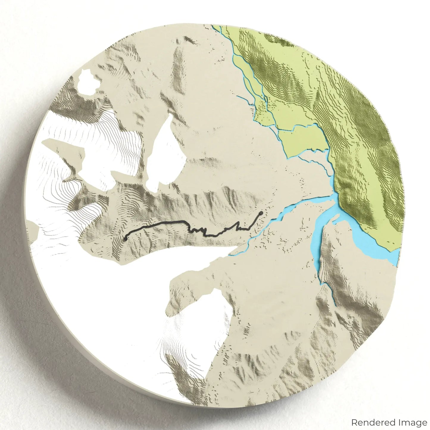
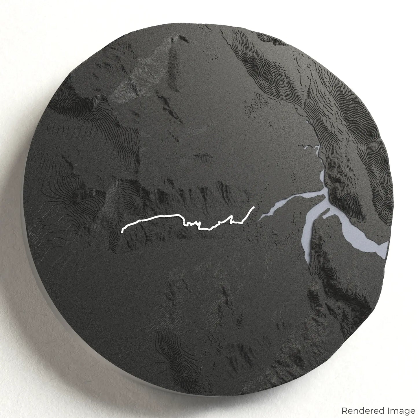
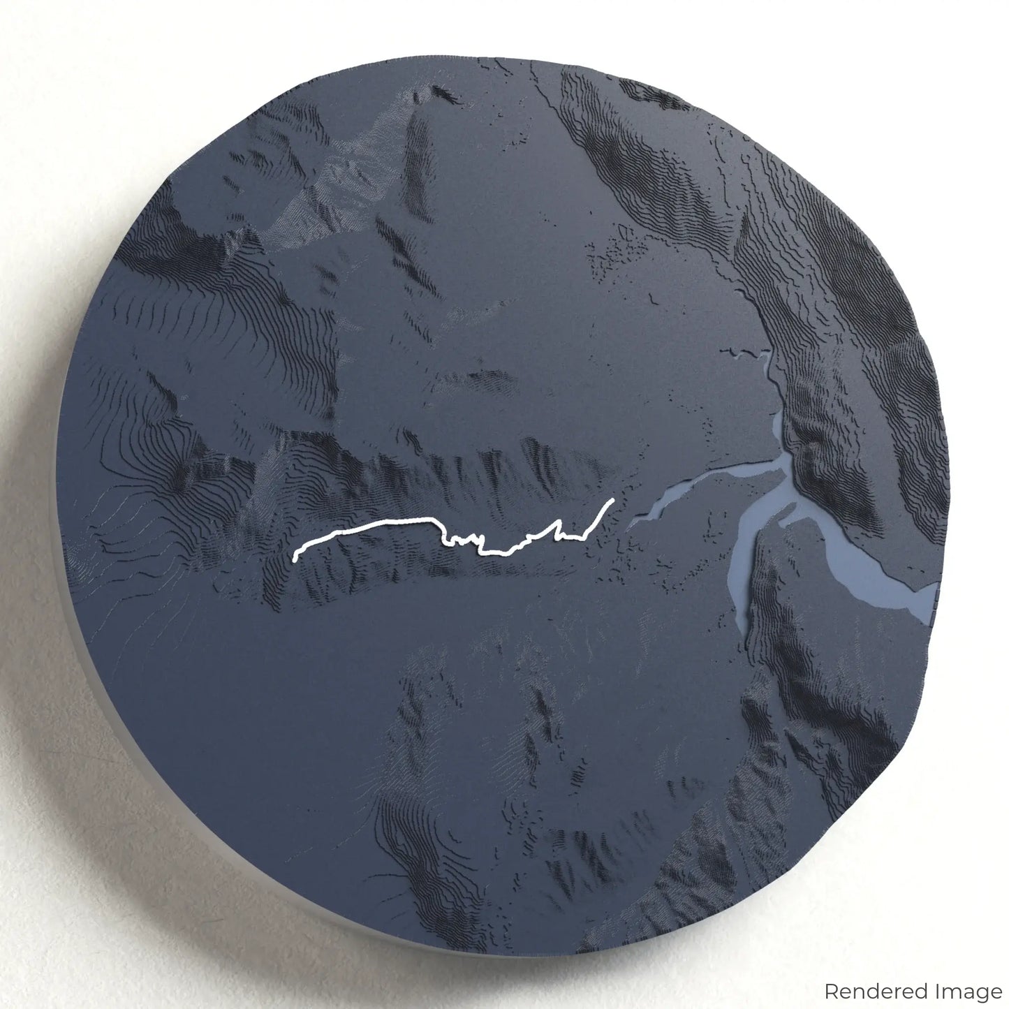
Trek the Harding Icefield Trail
Embark on an unforgettable journey through Alaska’s stunning wilderness with our 3D topographic map of the Harding Icefield Trail. This spectacular hike takes you from lush forests to the icy expanse of one of North America’s largest icefields.
A Hike Through Glacial Grandeur
The Harding Icefield Trail spans approximately 13 kilometres (8.2 miles) round trip, climbing nearly 1,000 metres (3,300 feet) to breathtaking views of the vast icefield stretching beyond the horizon. Hikers pass through alpine meadows, rugged switchbacks, and dramatic cliffs before reaching the iconic Harding Icefield overlook. Whether you've completed this exhilarating trek or aspire to, our handcrafted map captures the magnificence of the Harding Icefield Trail.
Personalise Your Adventure Keepsake
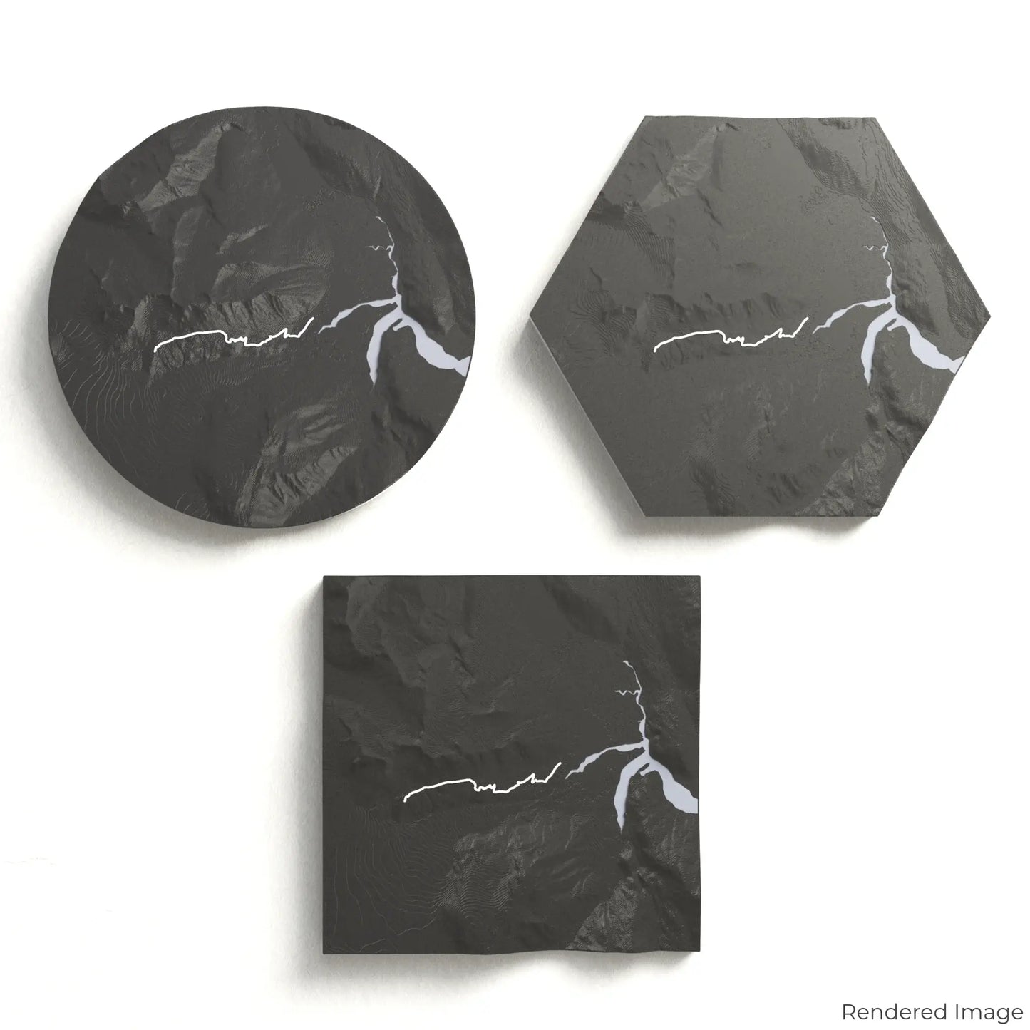
Choose from four striking colour themes and three unique shapes to create a stunning centrepiece for your wall or table. This handcrafted map is the perfect way to commemorate your Harding Icefield journey or as a meaningful gift for fellow explorers.
Choose the Perfect Size and Shape
Circle: 222 x 222 x 35 mm (8.7 x 8.7 x 1.4 inches)
Hexagon: 242 x 212 x 35 mm (9.5 x 8.3 x 1.4 inches)
Square: 198 x 198 x 35 mm (7.8 x 7.8 x 1.4 inches)
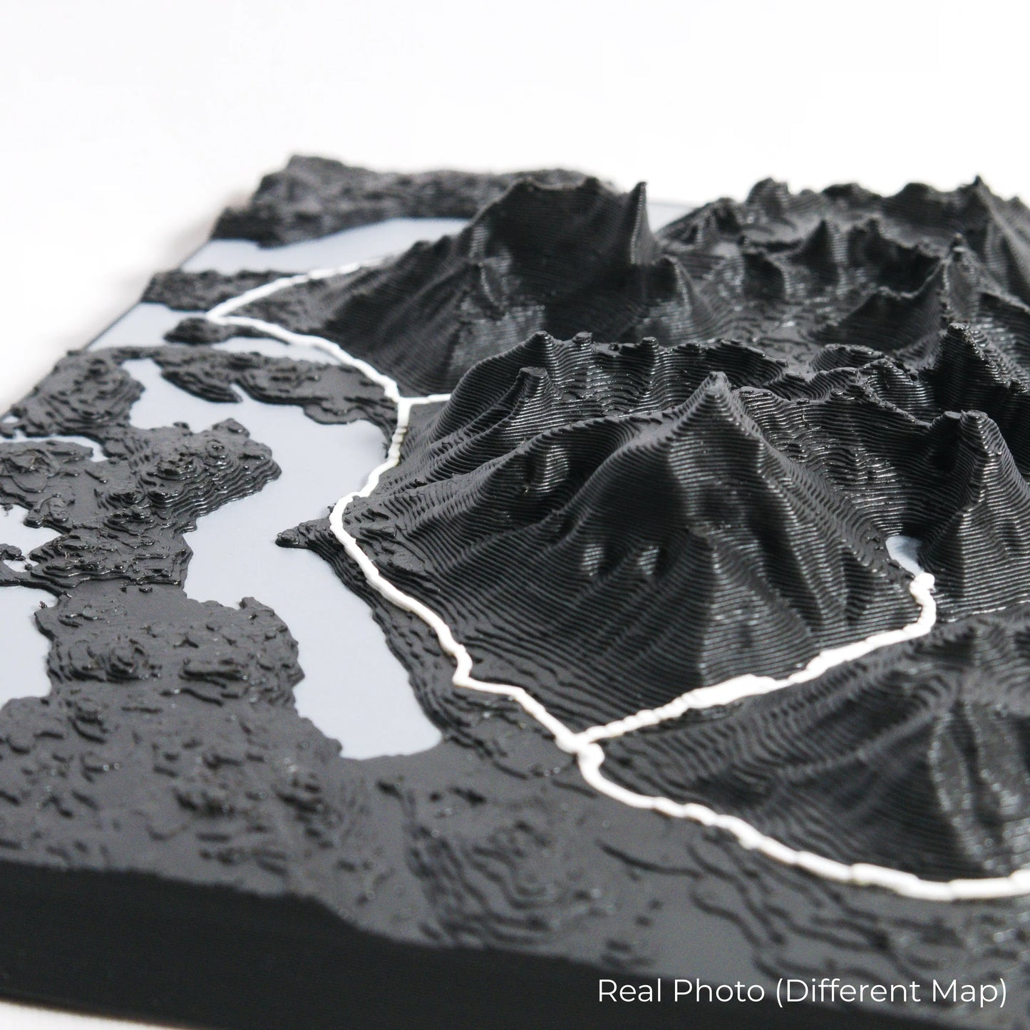
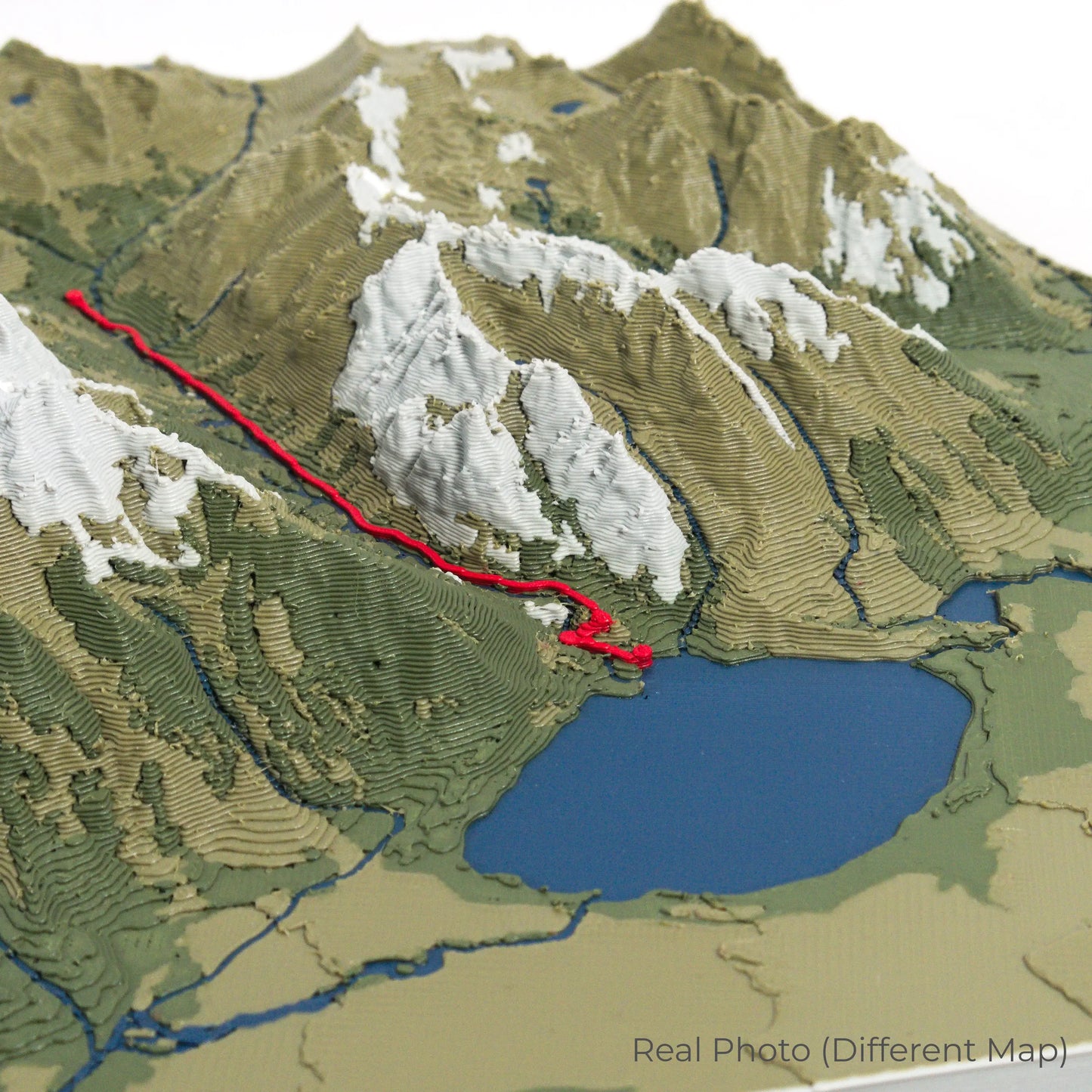
Crafted for Detail and Durability
Our maps are meticulously crafted using advanced colour 3D printing technology and PLA, a durable and plant-based plastic.
Please Note: Some product photos are digitally rendered for illustrative purposes and are labelled as "Rendered Image" for clarity. The actual product may show slight variations and natural imperfections due to the 3D printing process and material properties.
Take a Piece of Alaska Home
Celebrate your love for Alaska’s rugged landscapes with this one-of-a-kind keepsake. Whether you're reliving cherished memories or planning your next adventure, this 3D map is a tribute to the breathtaking beauty of the Harding Icefield Trail.
Order now and let us create a memento as unforgettable as your journey!
Data Sources
Our maps are created using high-precision topographic data from the following sources:
OpenStreetMap: openstreetmap.org/copyright
Copernicus WorldDEM-30: Produced using Copernicus WorldDEM-30 © DLR e.V. 2010-2014 and © Airbus Defence and Space GmbH 2014-2018, provided under COPERNICUS by the European Union and ESA; all rights reserved.