Mapped3D 3D Printed Maps Auckland, New Zealand
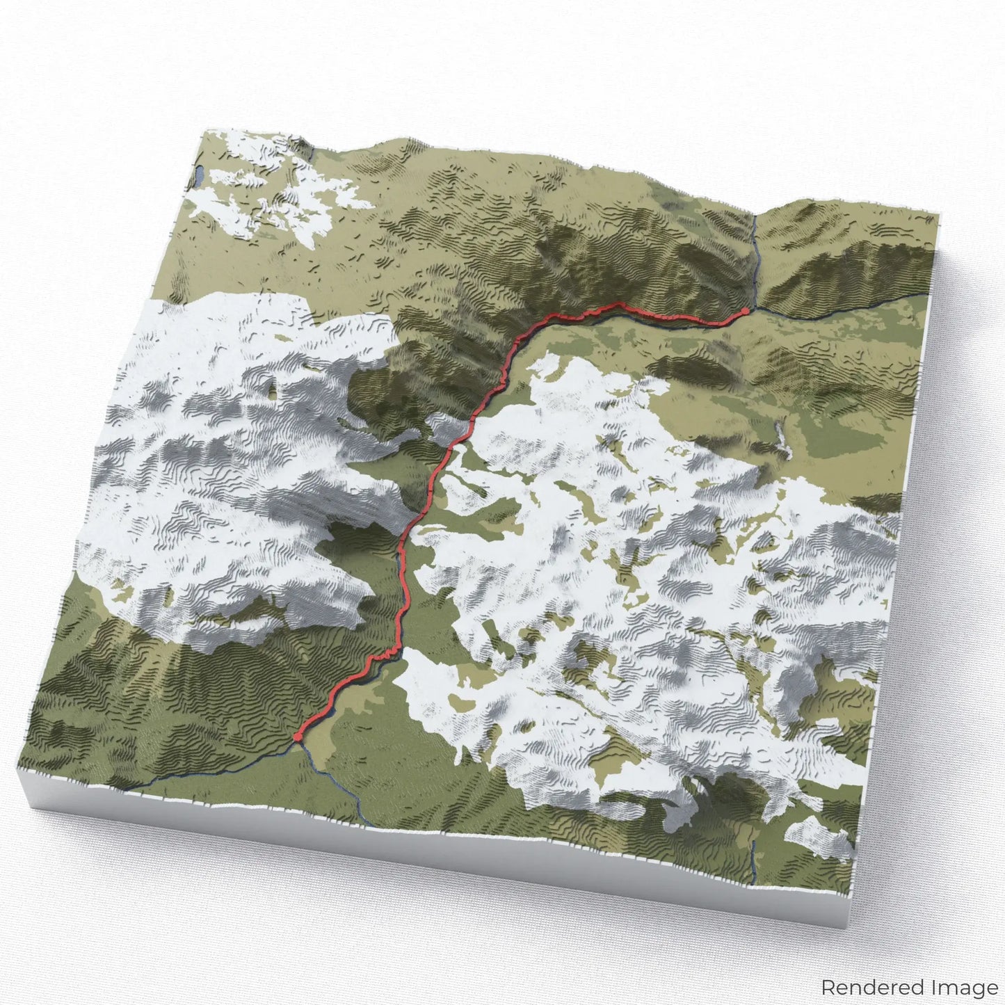
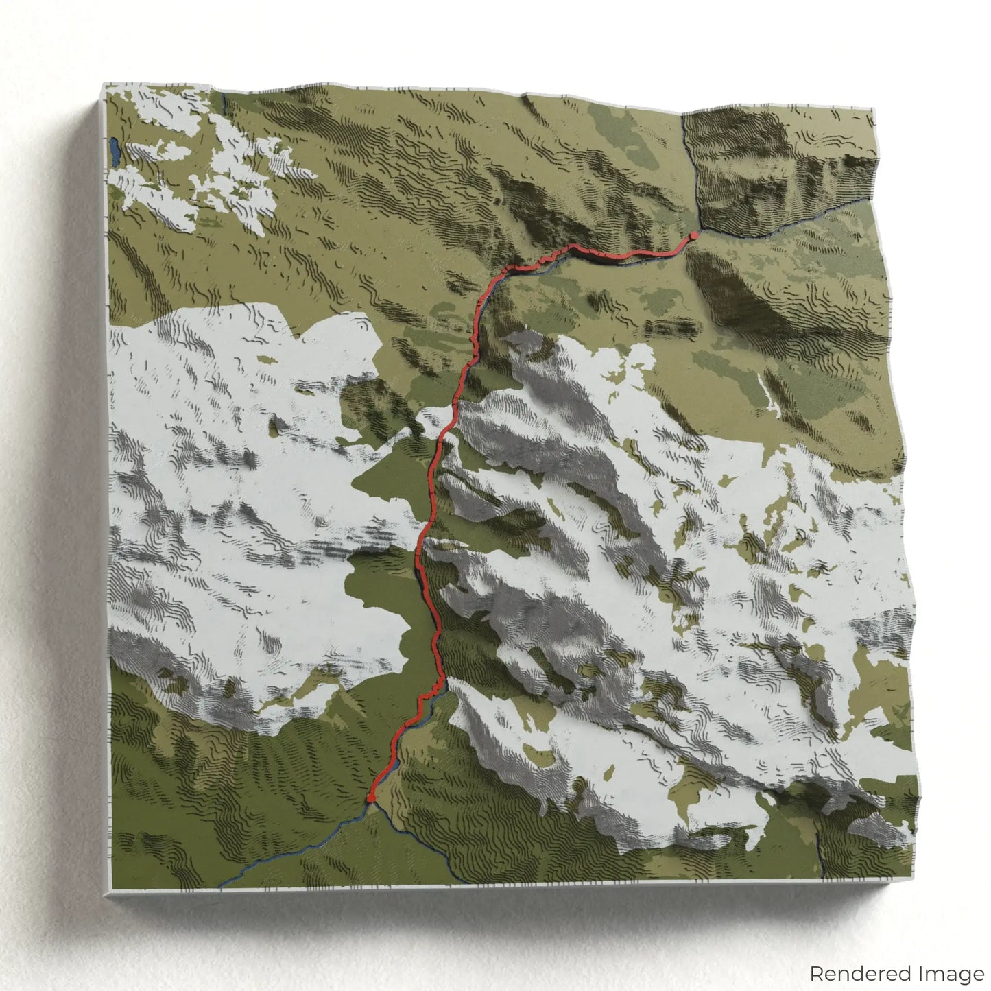
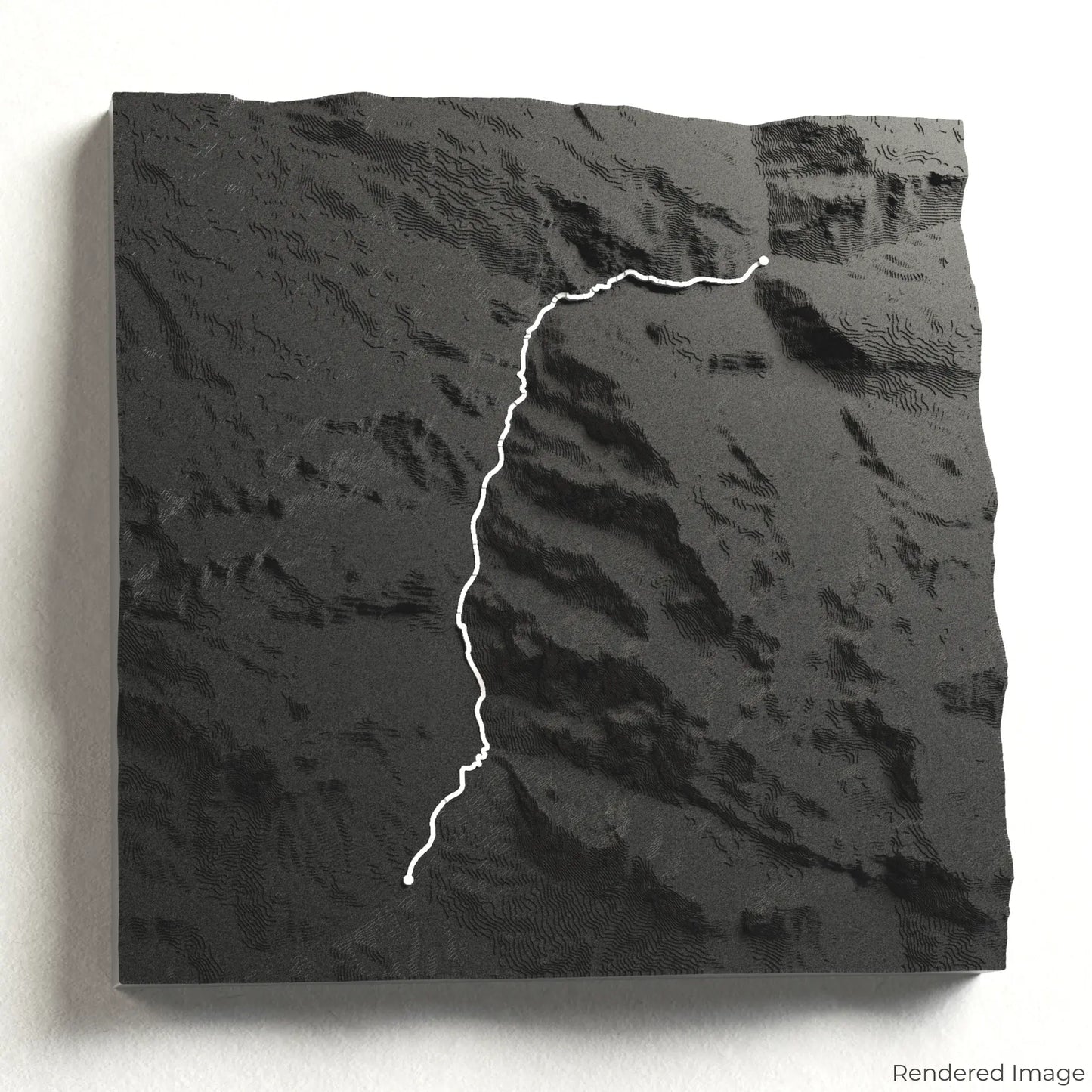
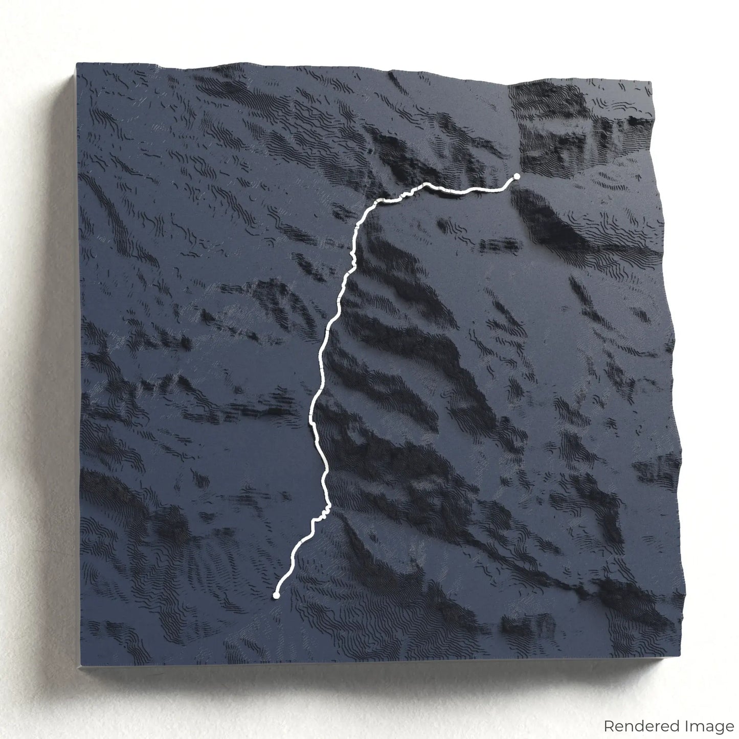
Cares Trail 3D Map
Cares Trail 3D Map
ORDERS NOT SHIPPED TILL SEPTEMBER!!!
Couldn't load pickup availability
Explore the Spectacular Cares Trail
Journey through one of Spain’s most breathtaking gorges with our 3D topographic map of the Cares Trail. This iconic path winds through towering limestone cliffs, dramatic ravines, and crystal-clear rivers in the heart of the Picos de Europa.
A Path Through Spain’s Wild Landscapes
The Cares Trail stretches approximately 24 kilometres (15 miles) round trip, connecting the villages of Poncebos and Caín. Carved into the cliffs above the Cares River, this trail offers awe-inspiring views of deep gorges, cascading waterfalls, and rugged peaks. Whether you’ve hiked this legendary route or dream of experiencing it, our handcrafted map captures the beauty of the Cares Trail.
Commemorate Your Adventure with a Unique Keepsake
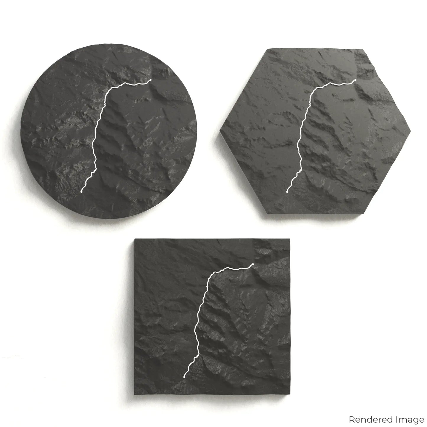
Choose from four striking colour themes and three unique shapes to create a stunning centrepiece for your wall or table. This handcrafted map is the perfect way to celebrate your Cares Trail journey or as a thoughtful gift for fellow explorers.
Select the Ideal Size and Shape
Circle: 222 x 222 x 34 mm (8.7 x 8.7 x 1.3 inches)
Hexagon: 242 x 212 x 34 mm (9.5 x 8.3 x 1.3 inches)
Square: 198 x 198 x 34 mm (7.8 x 7.8 x 1.3 inches)
Crafted with Precision and Detail
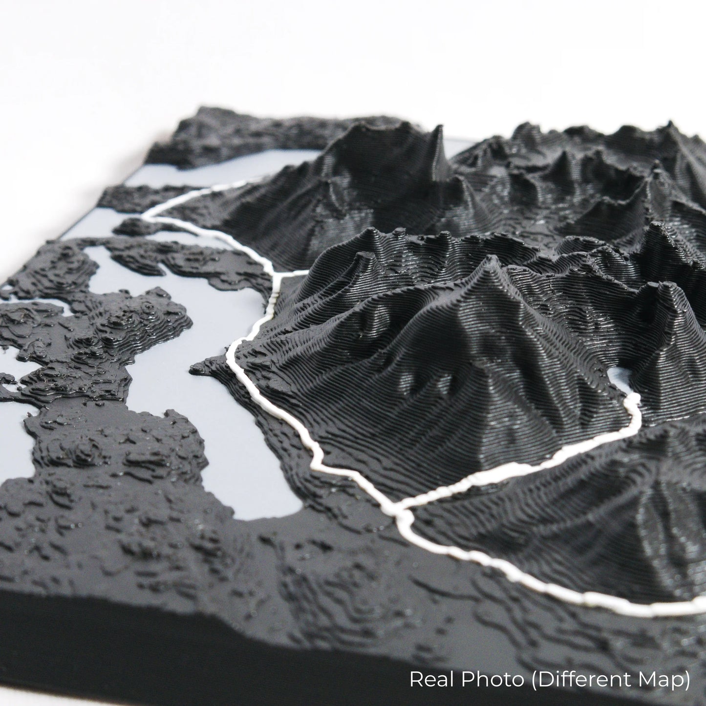
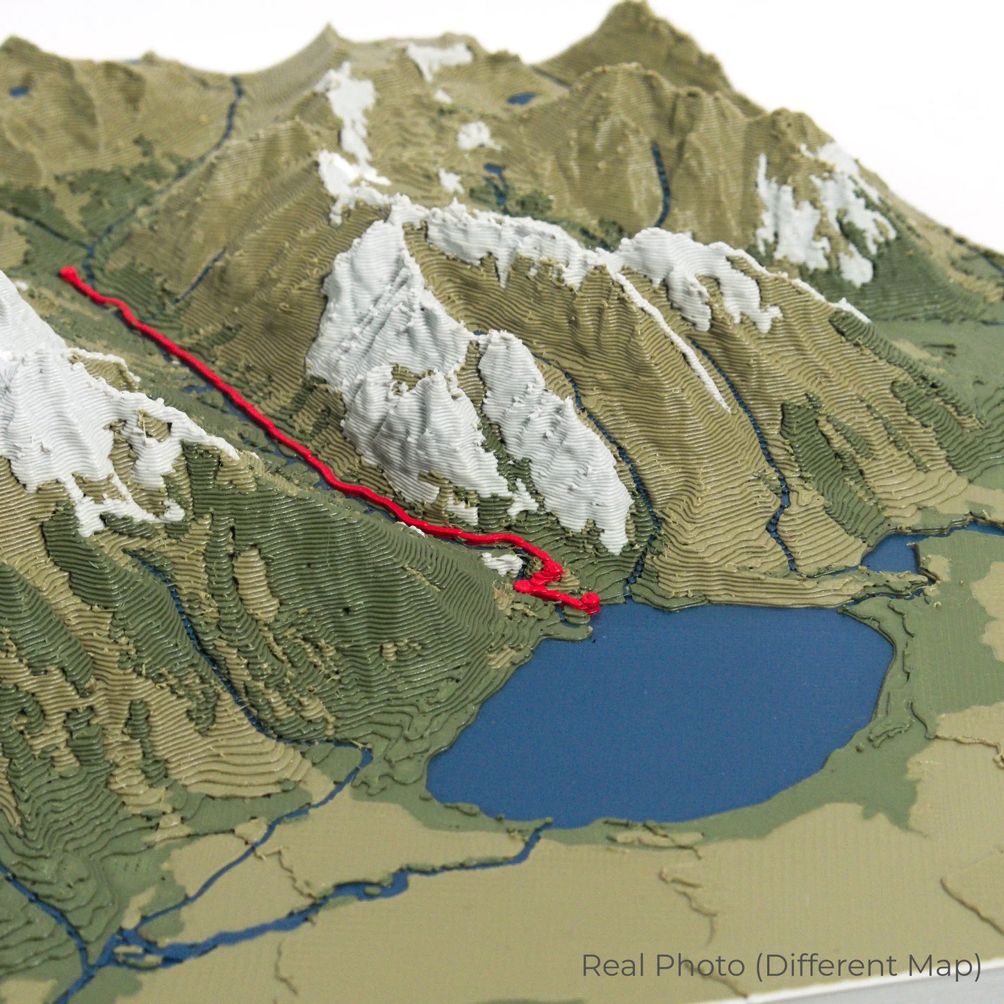
Our maps are meticulously designed using advanced colour 3D printing technology and PLA, a durable and plant-based plastic.
Please Note: Some product photos are digitally rendered for illustrative purposes and are labelled as "Rendered Image" for clarity. The actual product may show slight variations and natural imperfections due to the 3D printing process and material properties.
Bring the Spirit of the Picos de Europa Home
Celebrate your love for Spain’s dramatic landscapes with this one-of-a-kind keepsake. Whether you're reminiscing about past treks or planning your next outdoor adventure, this 3D map is a tribute to the beauty of the Cares Trail.
Order now and let us create a memento as unforgettable as your journey!
Data Sources
Our maps are created using high-precision topographic data from the following sources:
OpenStreetMap: openstreetmap.org/copyright
Copernicus WorldDEM-30: Produced using Copernicus WorldDEM-30 © DLR e.V. 2010-2014 and © Airbus Defence and Space GmbH 2014-2018, provided under COPERNICUS by the European Union and ESA; all rights reserved.
Share