Celebrate the Cape Wrath Trail
Discover the untamed beauty of Scotland’s wild north with our 3D topographic map of the Cape Wrath Trail. This epic trek is known for its remote landscapes and rugged charm, offering an unforgettable adventure for seasoned hikers.
A Journey Through Scotland’s Wilderness
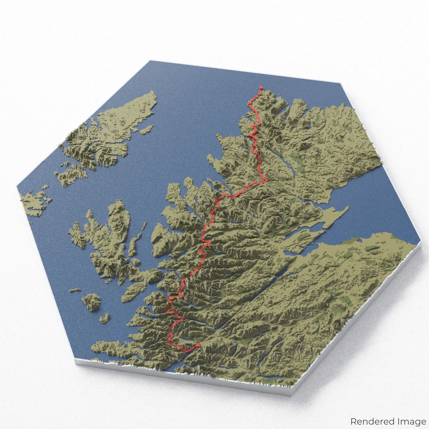
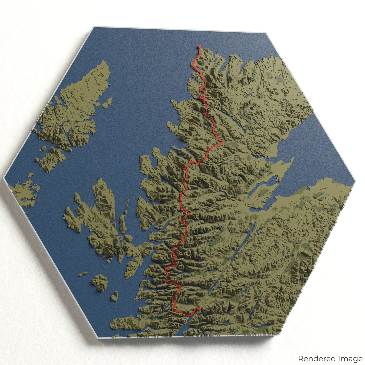
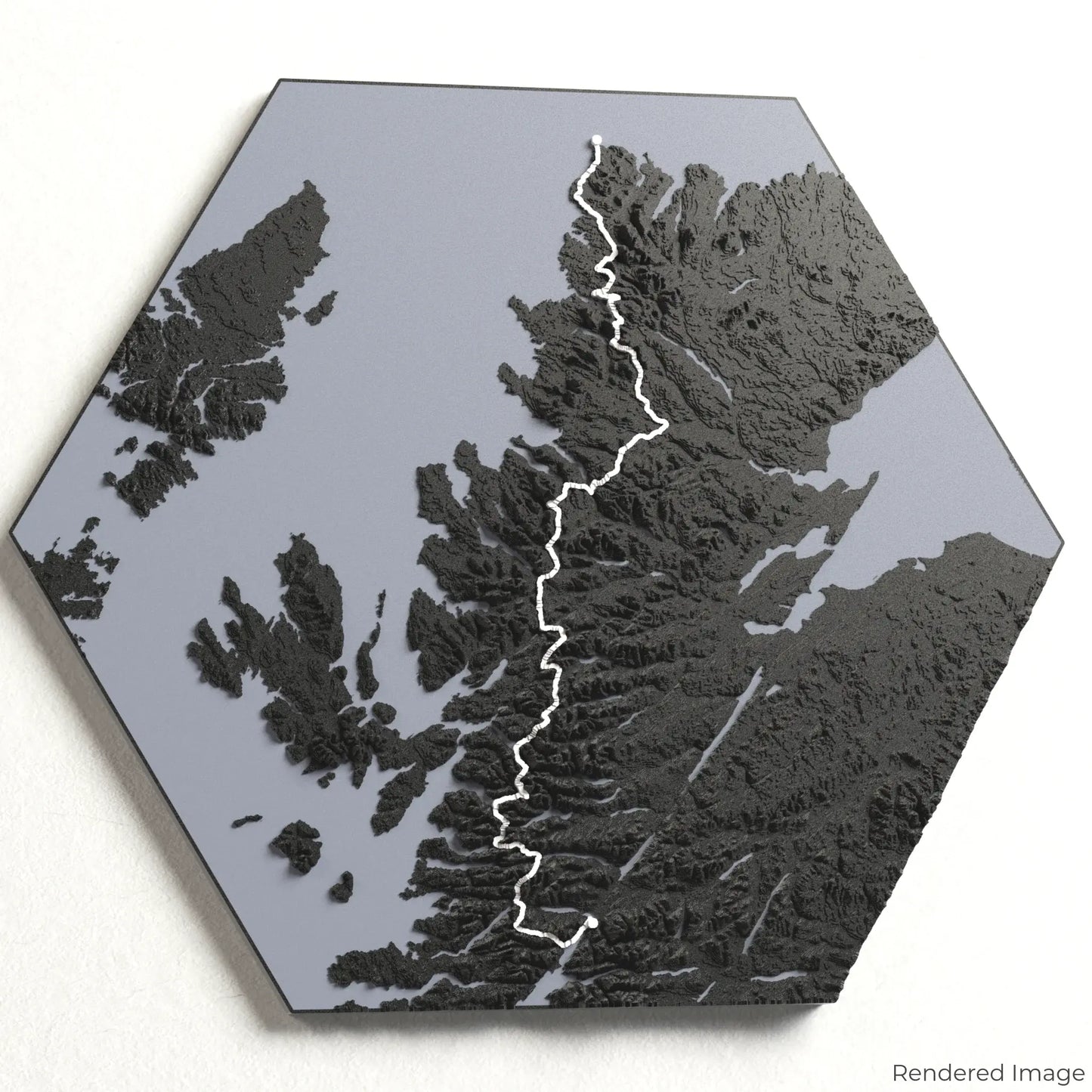
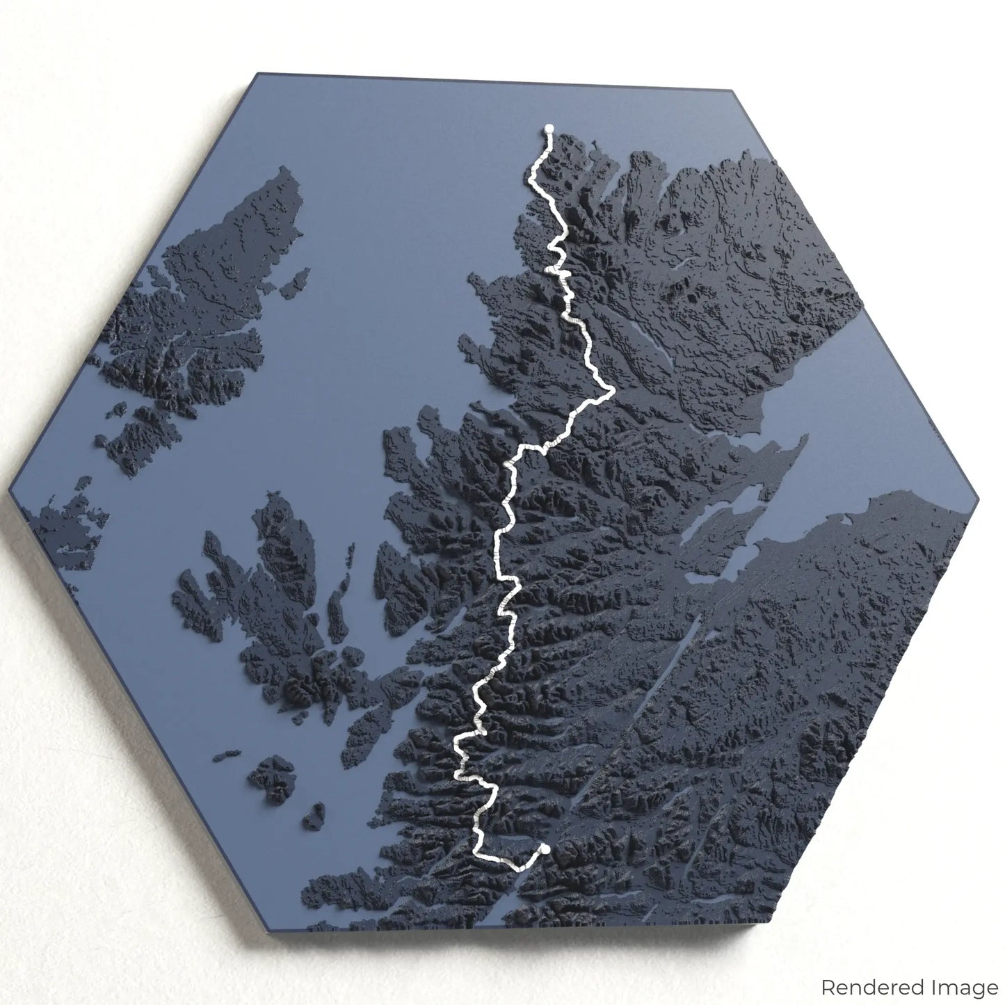
The Cape Wrath Trail spans approximately 370 kilometres (230 miles), guiding adventurers from Fort William to Cape Wrath through glens, mountains, and wild moorlands. This challenging route is beloved for its solitude, stunning views, and diverse scenery. Whether you’ve completed the trail or aspire to conquer it, our handcrafted map captures the spirit of the Cape Wrath Trail.
Customizable Keepsakes
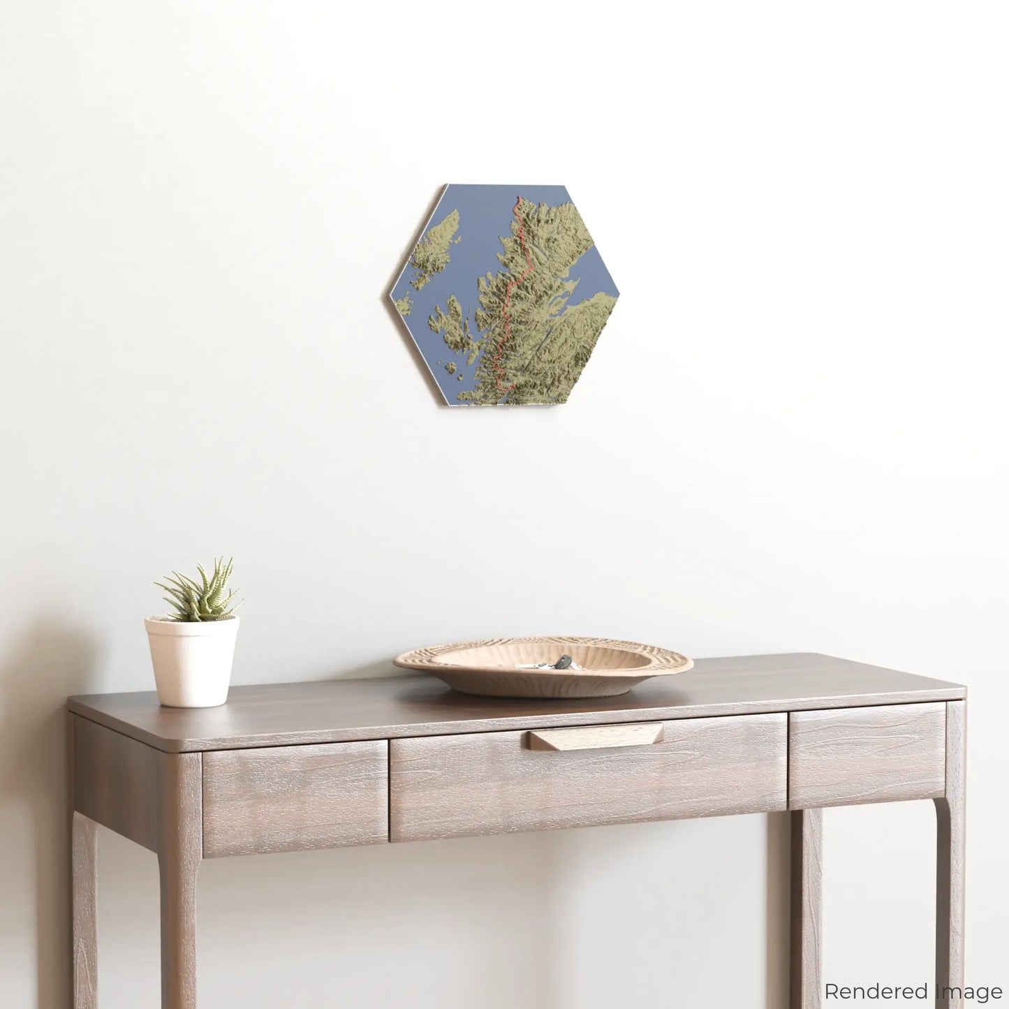
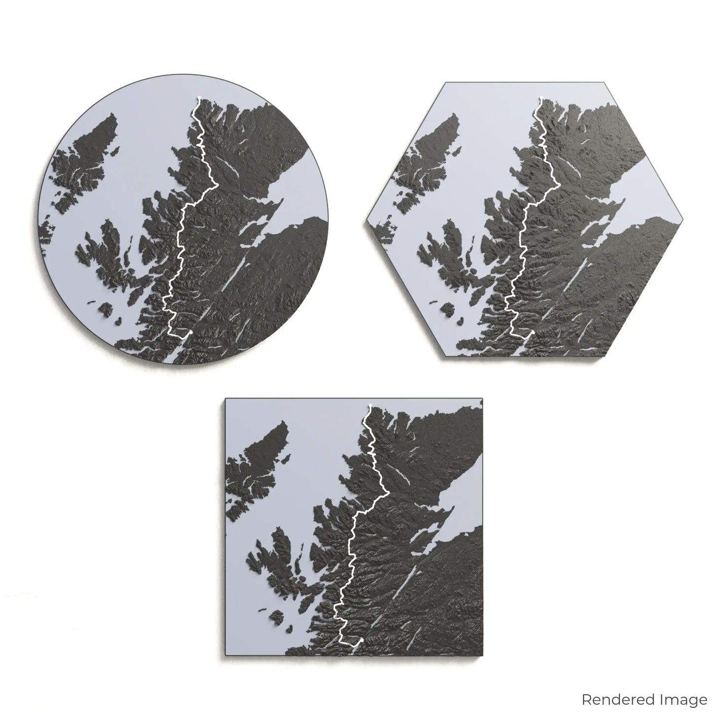
Choose from four striking colour themes and three unique shapes to create an eye-catching centrepiece for your wall or table. This handcrafted map is the perfect way to commemorate your trek along the Cape Wrath Trail or as a thoughtful gift for fellow explorers.
Available Sizes and Shapes
Circle: 222 x 222 x 14 mm (8.7 x 8.7 x 0.6 inches)
Hexagon: 242 x 212 x 14 mm (9.6 x 8.3 x 0.6 inches)
Square: 198 x 198 x 14 mm (7.8 x 7.8 x 0.6 inches)
Premium Craftsmanship
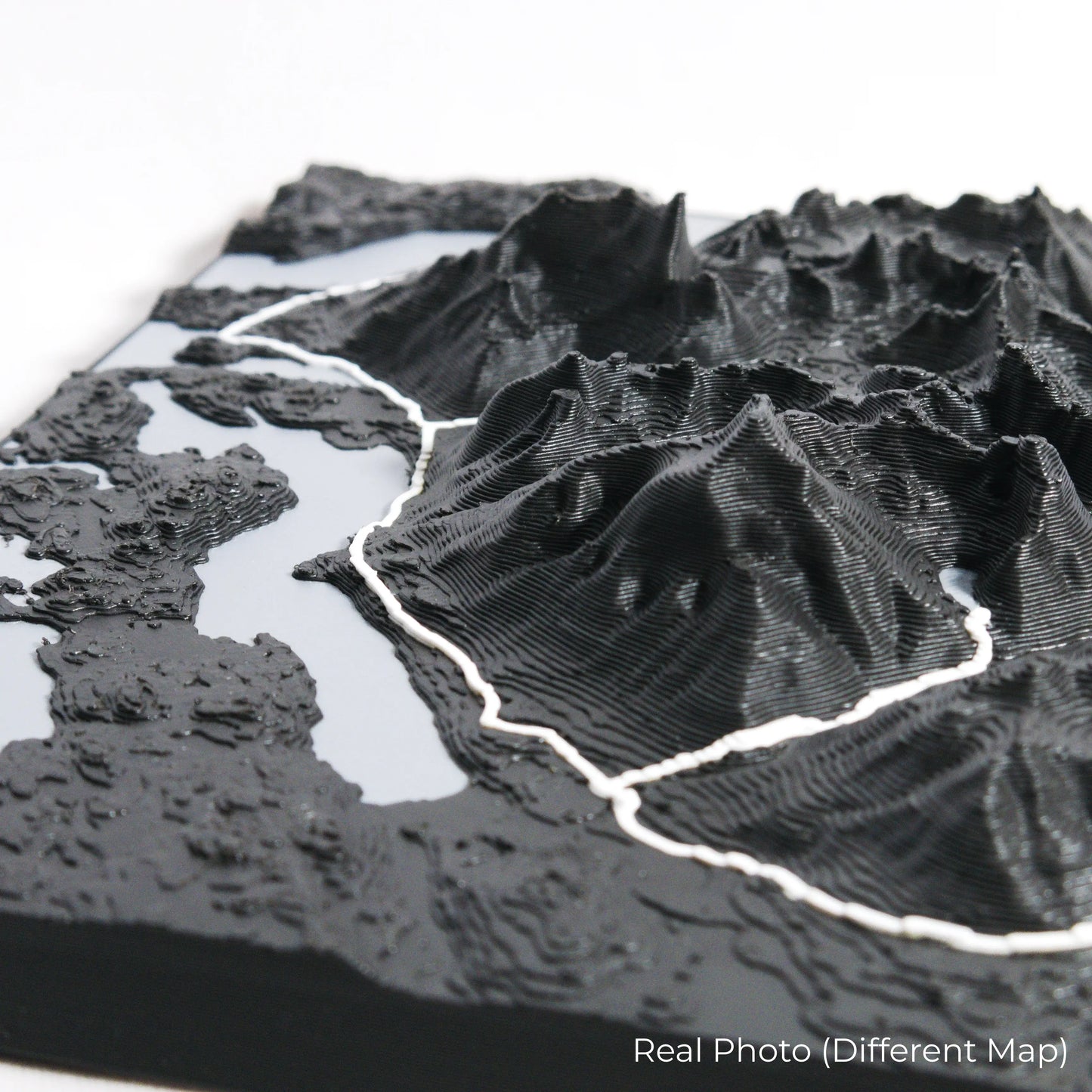
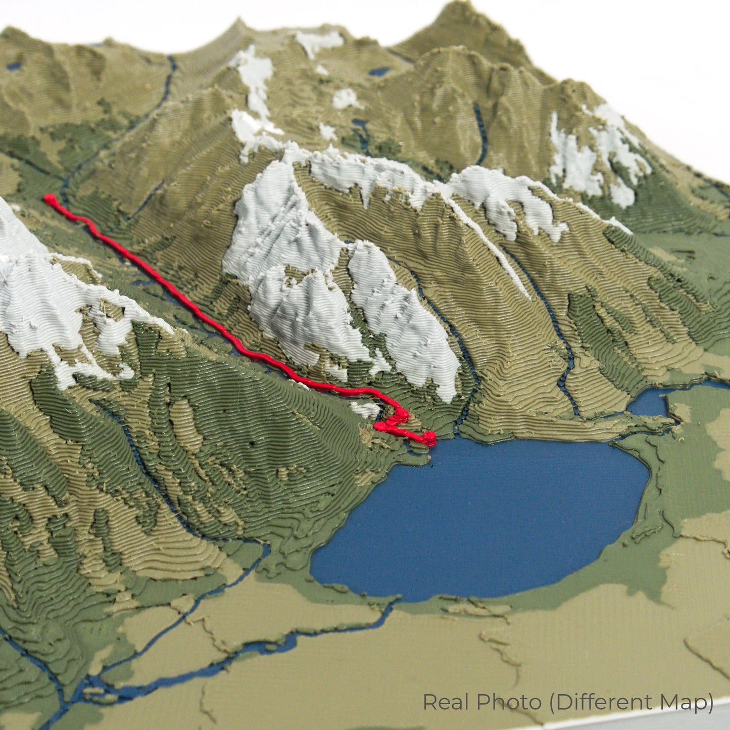
Our maps are meticulously crafted using advanced colour 3D printing technology and PLA, a durable and plant-based plastic.
Please Note: Some product photos are digitally rendered for illustrative purposes and are labelled as "Rendered Image" for clarity. The actual product may show slight variations and natural imperfections due to the 3D printing process and material properties.
Bring Scotland’s Wild North Home
Celebrate your love for remote adventures with this one-of-a-kind keepsake. Whether you're reliving cherished memories or inspiring your next journey, this 3D map is a testament to the natural beauty of the Cape Wrath Trail.
Order now and let us create a memento as unforgettable as your journey!
Data Sources
Our maps are created using high-precision topographic data from the following sources:
OpenStreetMap: openstreetmap.org/copyright
Copernicus WorldDEM-30: Produced using Copernicus WorldDEM-30 © DLR e.V. 2010-2014 and © Airbus Defence and Space GmbH 2014-2018, provided under COPERNICUS by the European Union and ESA; all rights reserved.