Mapped3D 3D Printed Maps Auckland, New Zealand
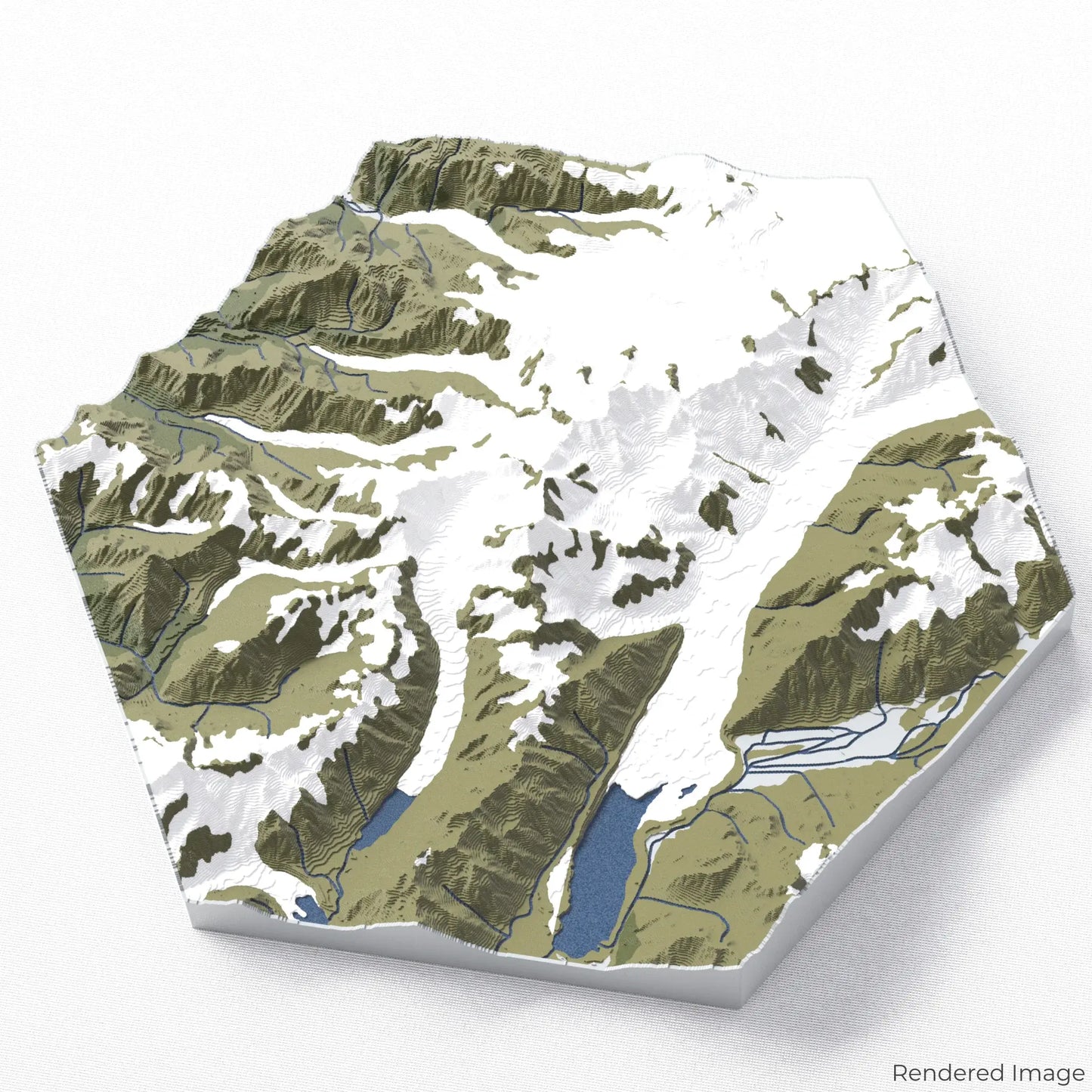
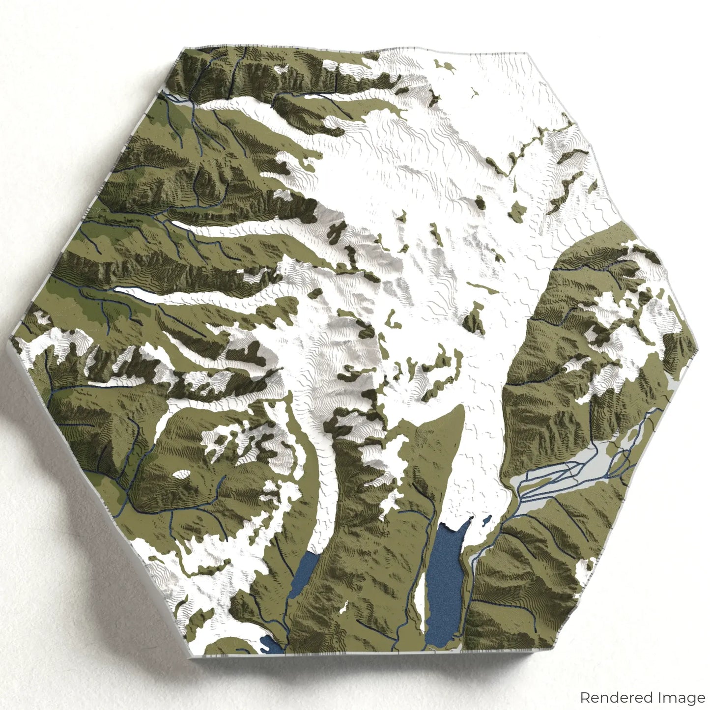
Aoraki / Mount Cook 3D Map
Aoraki / Mount Cook 3D Map
ORDERS NOT SHIPPED TILL SEPTEMBER!!!
Couldn't load pickup availability
Discover Aoraki/Mount Cook
Experience the majesty of New Zealand’s highest peak with our 3D topographic map of Aoraki/Mount Cook. This iconic mountain stands as a symbol of natural beauty and adventure, surrounded by glaciers, alpine meadows, and breathtaking vistas.
A Journey Through the Southern Alps
Aoraki/Mount Cook towers at 3,724 metres (12,218 feet) and is nestled within the rugged landscapes of Aoraki/Mount Cook National Park. The park features popular trails such as the Hooker Valley Track, Sealy Tarns Track, and Mueller Hut Route, each offering unique perspectives of this alpine wonder. Whether you've explored these trails or dream of doing so, our handcrafted map captures the essence of Aoraki/Mount Cook.
Create Your Memento
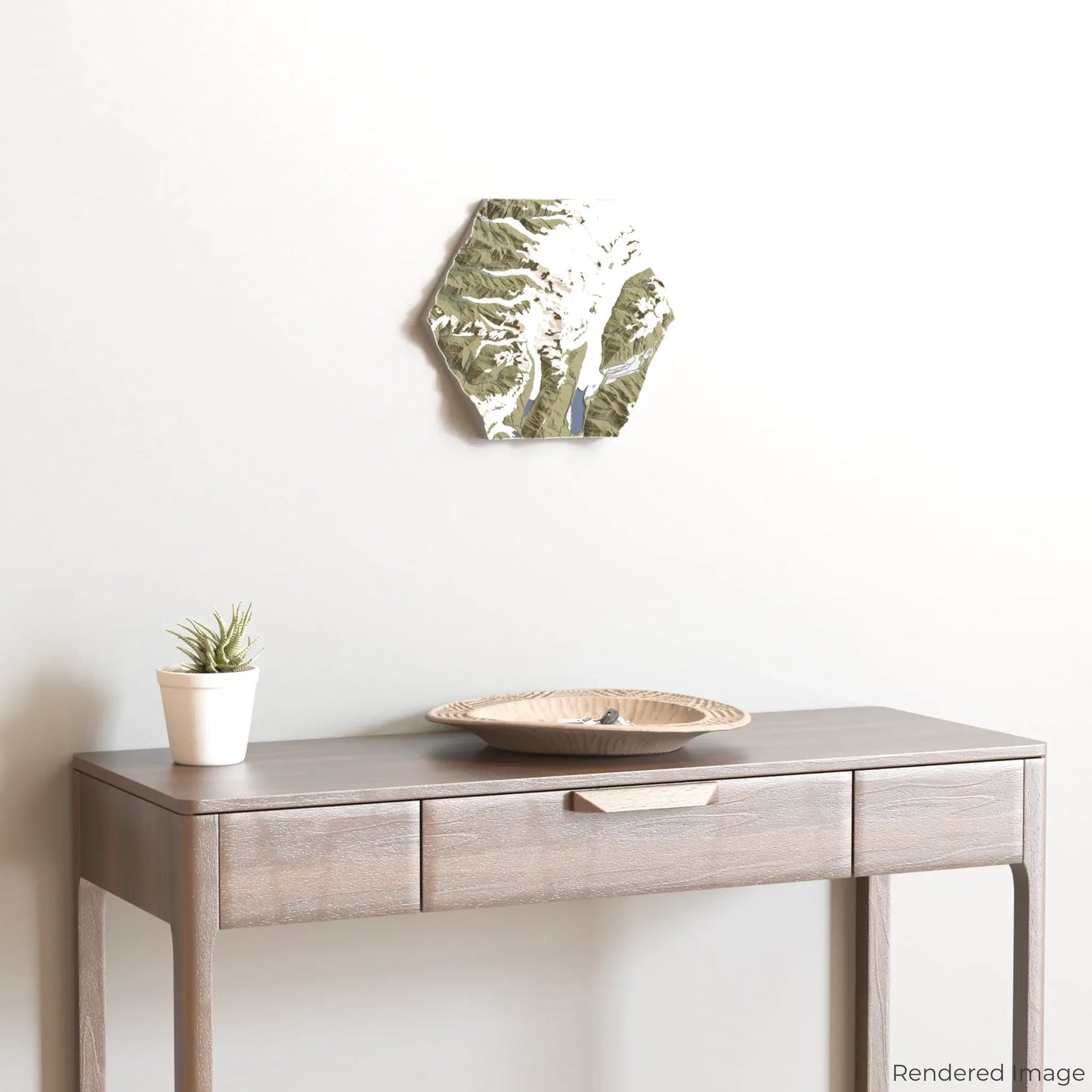
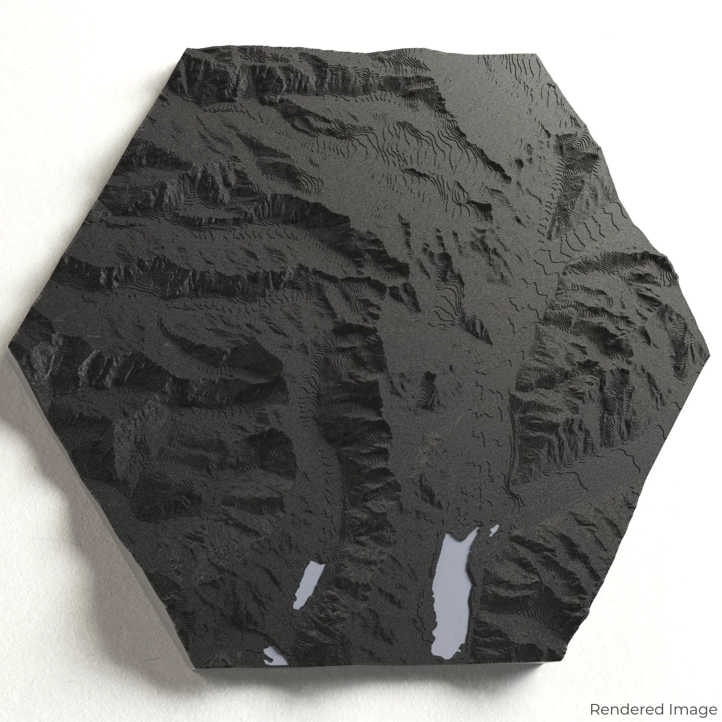
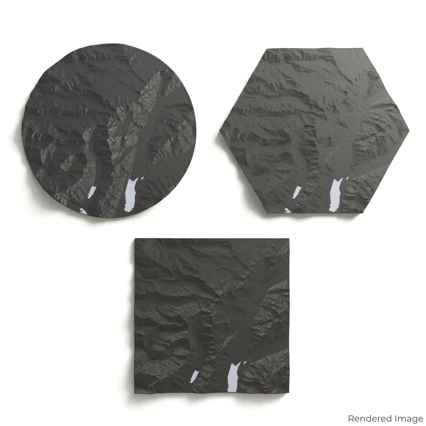
Choose from four striking colour themes and three unique shapes to create an eye-catching centrepiece for your wall or table. This handcrafted map is the perfect way to commemorate your adventure to Aoraki/Mount Cook or as a thoughtful gift for fellow adventurers.
Available Sizes and Shapes
Circle: 222 x 222 x 35 mm (8.7 x 8.7 x 1.4 inches
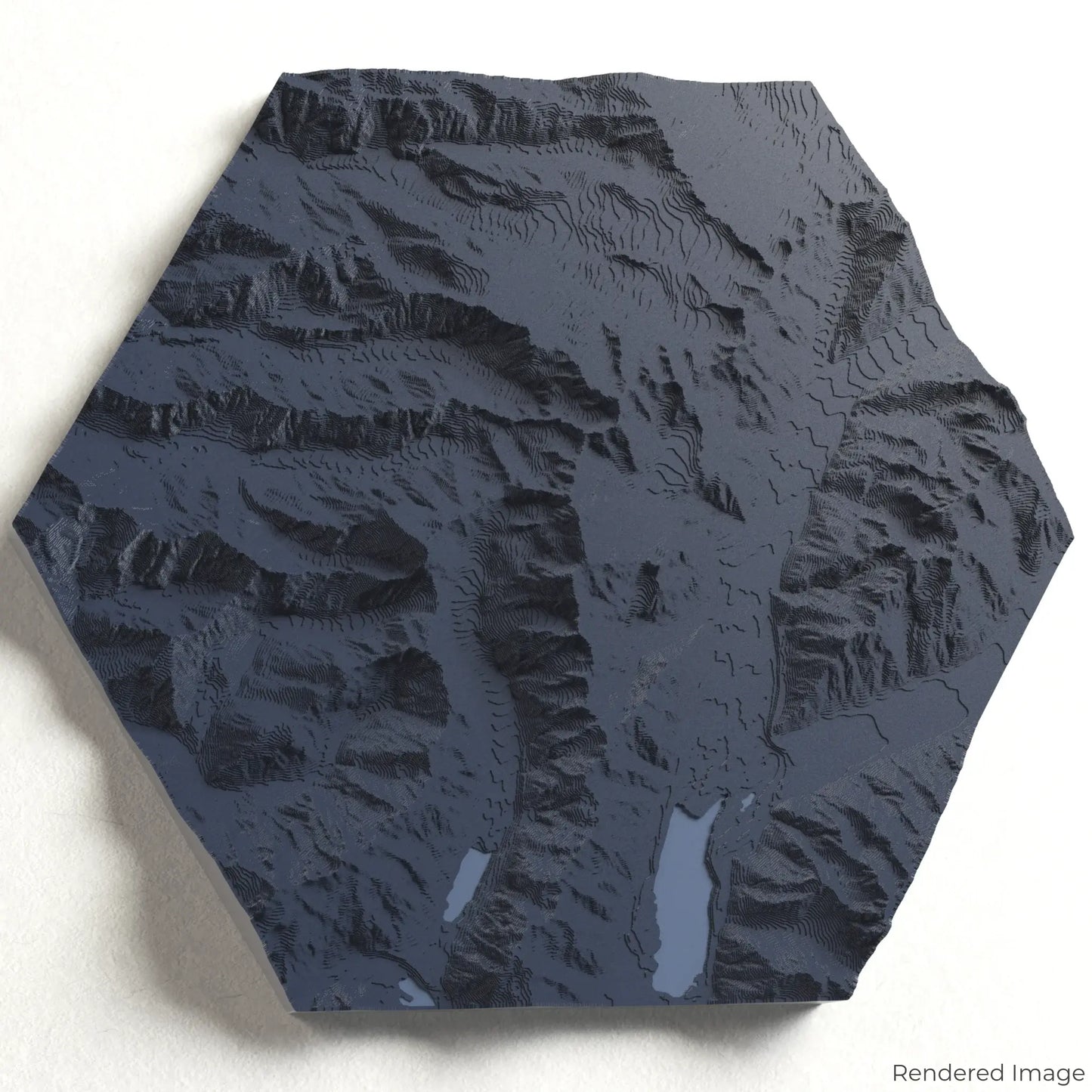
Hexagon: 242 x 212 x 35 mm (9.5 x 8.3 x 1.4 inches)
Square: 198 x 198 x 35 mm (7.8 x 7.8 x 1.4 inches)
Expert Craftsmanship
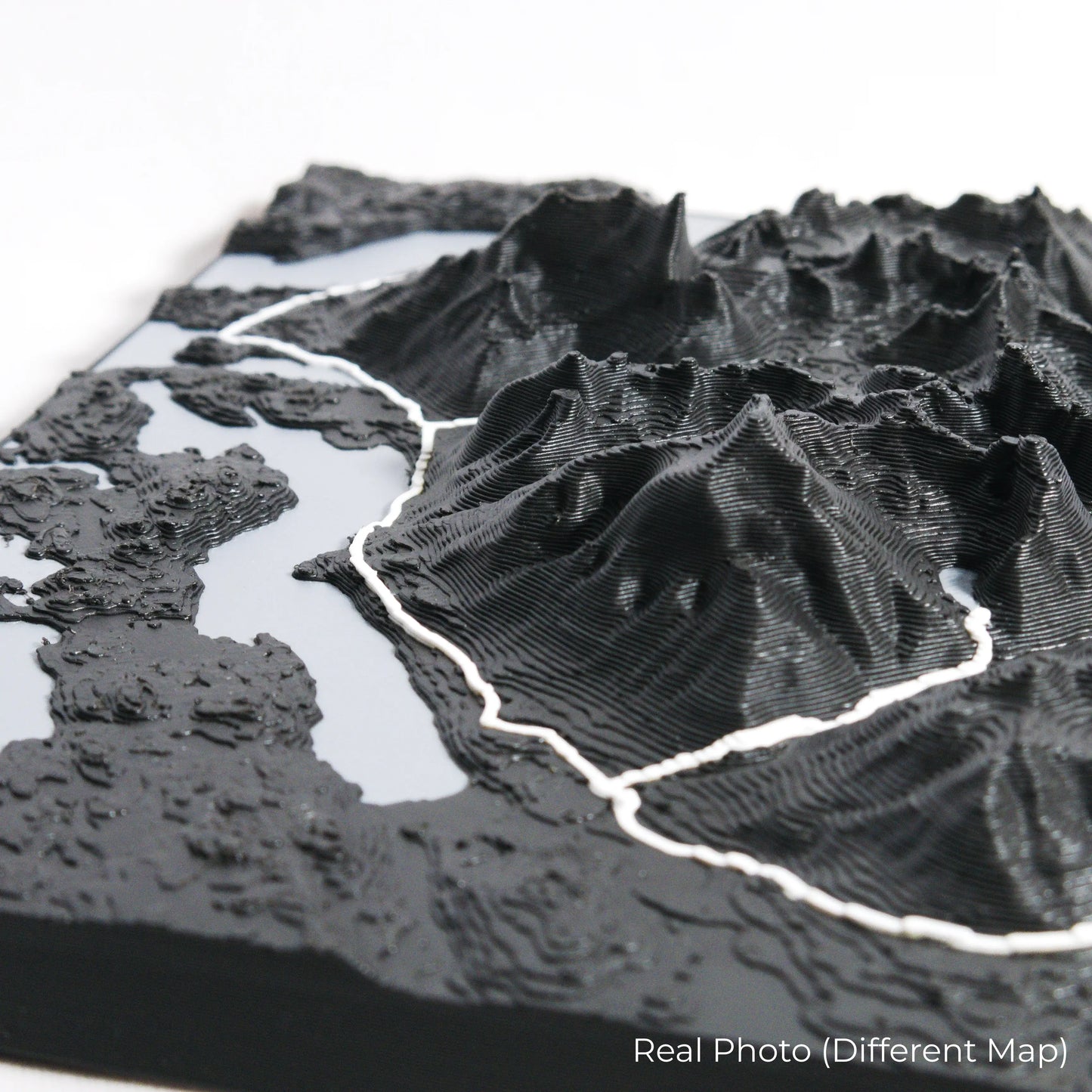
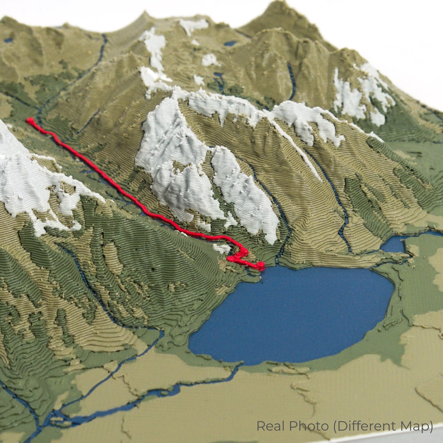
Our maps are meticulously crafted using advanced colour 3D printing technology and PLA, a durable and plant-based plastic.
Please Note: Some product photos are digitally rendered for illustrative purposes and are labelled as "Rendered Image" for clarity. The actual product may show slight variations and natural imperfections due to the 3D printing process and material properties.
Bring New Zealand’s Highest Peak Home
Celebrate your love for Aoraki/Mount Cook with this one-of-a-kind keepsake. Whether you're reliving cherished memories or planning your next alpine adventure, this 3D map is a testament to the dramatic beauty of the Southern Alps.
Order now and let us create a memento as unforgettable as your journey!
Data Sources
Our maps are created using high-precision topographic data from the following sources:
OpenStreetMap: openstreetmap.org/copyright
Copernicus WorldDEM-30: Produced using Copernicus WorldDEM-30 © DLR e.V. 2010-2014 and © Airbus Defence and Space GmbH 2014-2018, provided under COPERNICUS by the European Union and ESA; all rights reserved.
Share