Mapped3D 3D Printed Maps Auckland, New Zealand
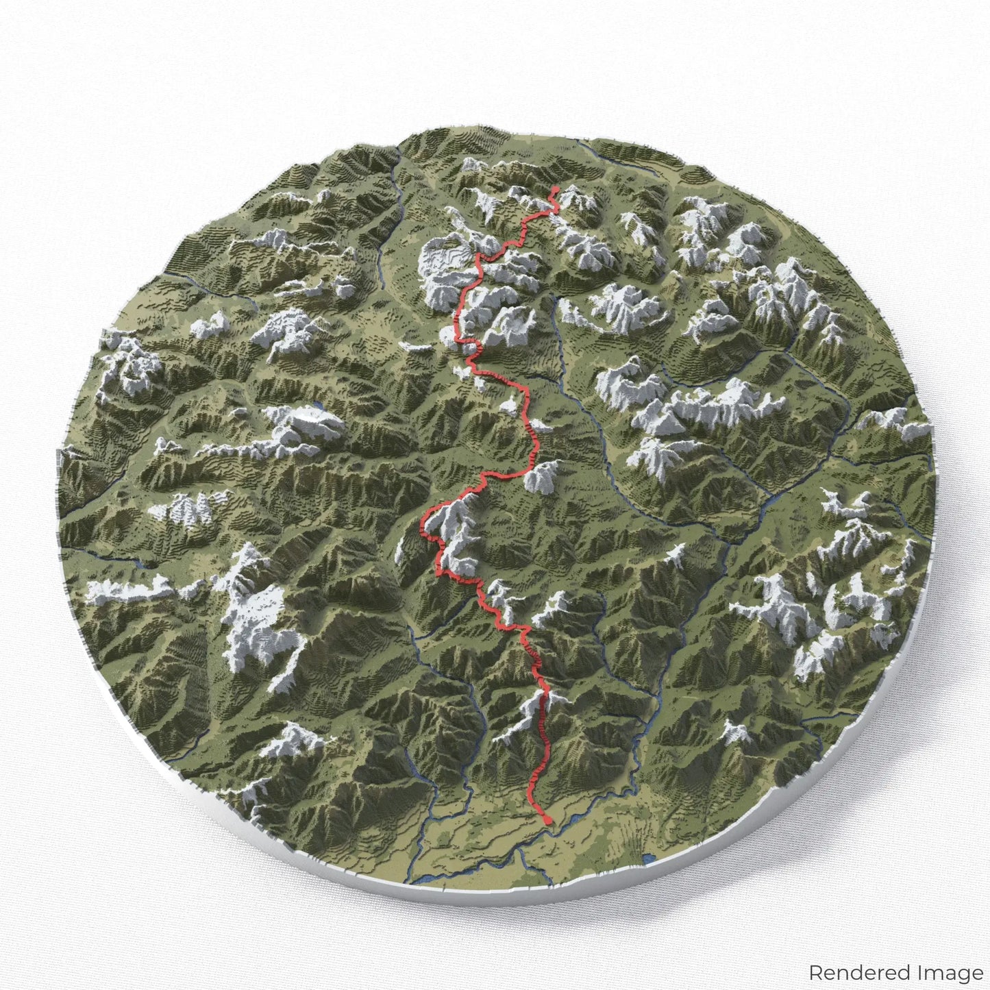
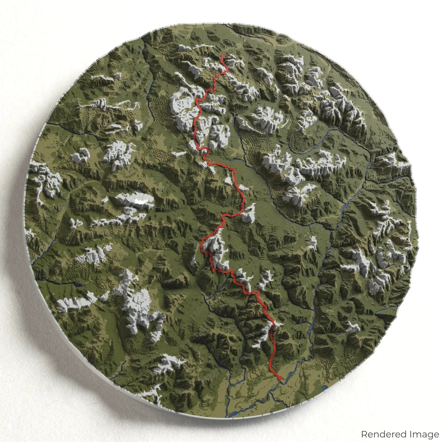
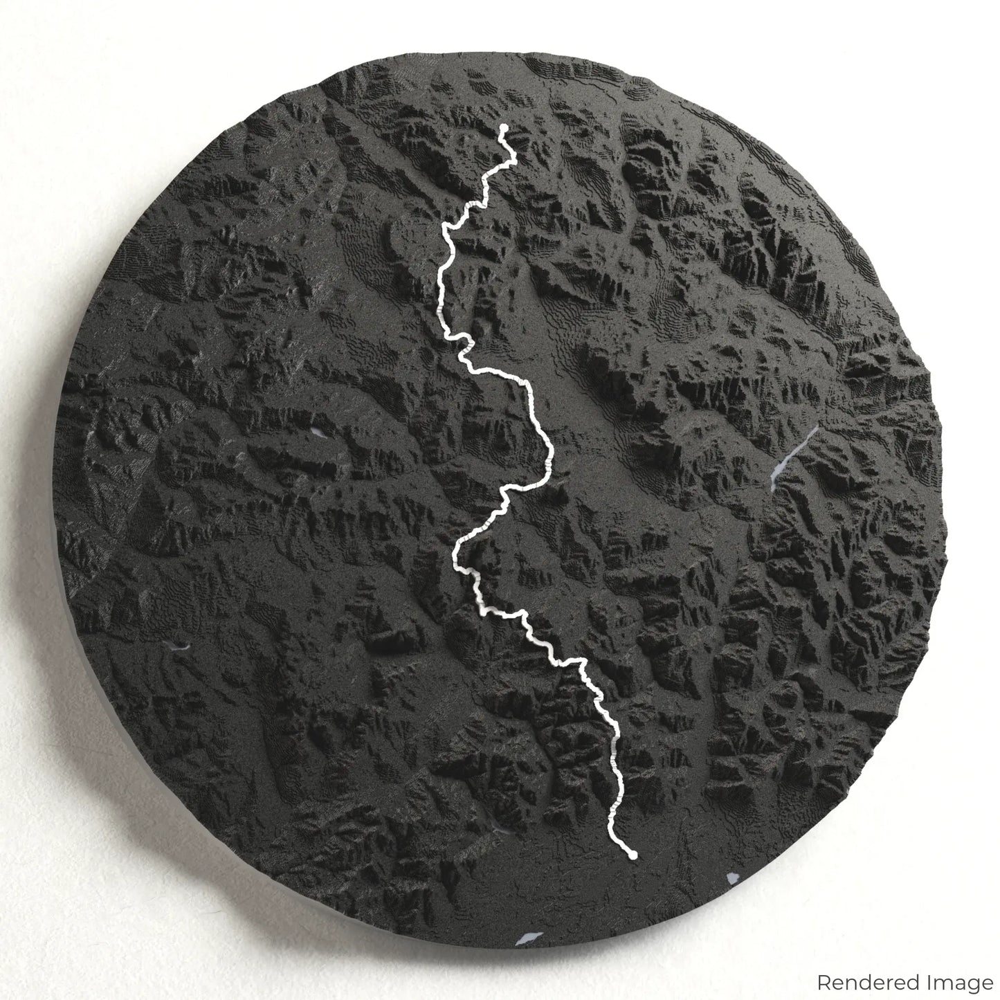
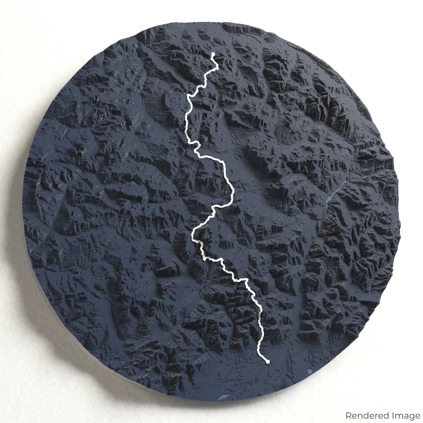
Alta Via 1 3D Map
Alta Via 1 3D Map
ORDERS NOT SHIPPED TILL SEPTEMBER!!!
Couldn't load pickup availability
Trek the Stunning Alta Via 1
Explore the breathtaking landscapes of the Italian Dolomites with our 3D topographic map of the Alta Via 1. This world-famous high-altitude route takes hikers through dramatic peaks, alpine meadows, and historic mountain huts.
A Journey Through the Heart of the Dolomites
The Alta Via 1 stretches approximately 120 kilometres (75 miles), guiding hikers through rugged limestone formations, scenic passes, and lush valleys. Highlights include the awe-inspiring Tofane Massif, the enchanting Lago di Braies, and panoramic views from Lagazuoi. Whether you've trekked this spectacular route or dream of doing so, our handcrafted map captures the essence of the Alta Via 1.
Create Your Ultimate Trail Keepsake
Select from four striking colour themes and three unique shapes to create a stunning centrepiece for your wall or table. This handcrafted map is the perfect way to commemorate your Alta Via 1 adventure or as a meaningful gift for fellow mountaineers.
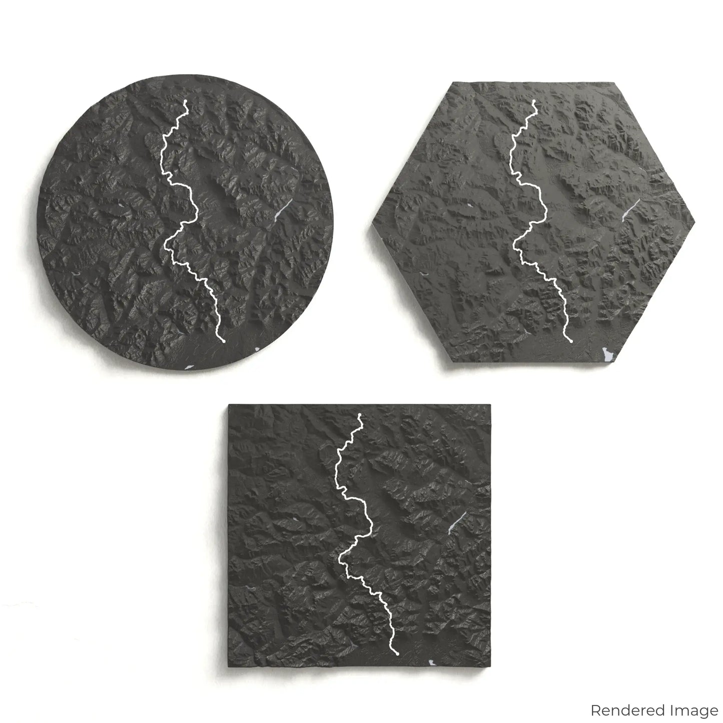
Choose the Perfect Size and Shape
Circle: 222 x 222 x 24 mm (8.7 x 8.7 x 0.9 inches)
Hexagon: 243 x 212 x 24 mm (9.6 x 8.3 x 0.9 inches)
Square: 198 x 198 x 24 mm (7.8 x 7.8 x 0.9 inches)
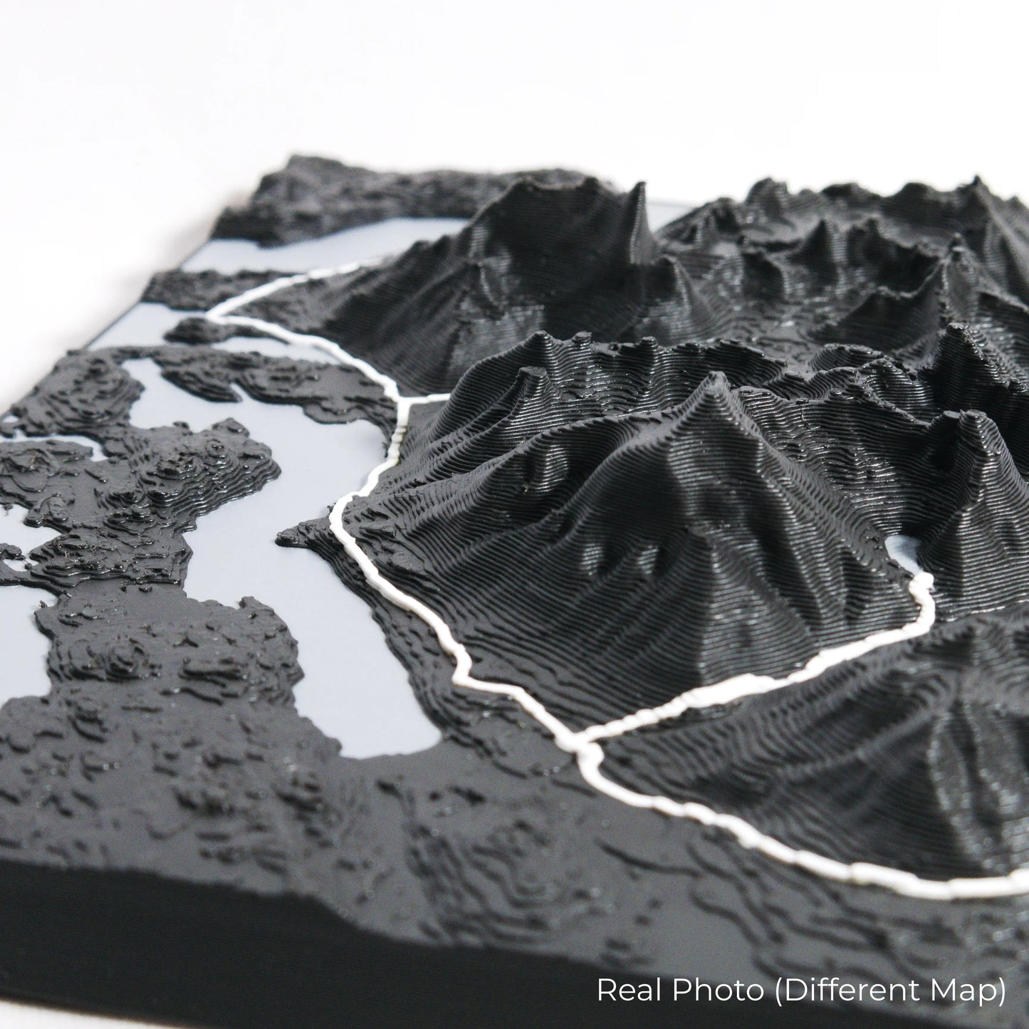
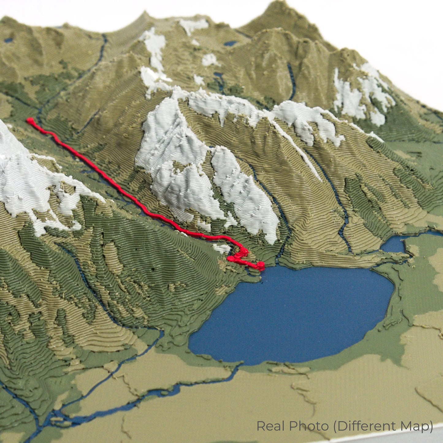
Expertly Crafted for Lasting Detail
Our maps are meticulously designed using advanced colour 3D printing technology and PLA, a durable and plant-based plastic.
Please Note: Some product photos are digitally rendered for illustrative purposes and are labelled as "Rendered Image" for clarity. The actual product may show slight variations and natural imperfections due to the 3D printing process and material properties.
Bring the Dolomites Home
Celebrate your love for the Italian Alps with this one-of-a-kind keepsake. Whether you're reminiscing about past treks or planning your next mountain adventure, this 3D map is a tribute to the beauty of the Alta Via 1.
Order now and let us create a memento as unforgettable as your journey!
Data Sources
Our maps are created using high-precision topographic data from the following sources:
OpenStreetMap: openstreetmap.org/copyright
Copernicus WorldDEM-30: Produced using Copernicus WorldDEM-30 © DLR e.V. 2010-2014 and © Airbus Defence and Space GmbH 2014-2018, provided under COPERNICUS by the European Union and ESA; all rights reserved.
Share